Trail Maps and Guides
![]() Explore a state park trail system with the interactive Alaska Mapper - State Parks and Trails. This Service is not updated regularly; please visit trail conditions for the latest condition reports. For more information, visit Alaska Mapper.
Explore a state park trail system with the interactive Alaska Mapper - State Parks and Trails. This Service is not updated regularly; please visit trail conditions for the latest condition reports. For more information, visit Alaska Mapper.
![]() Visualize trails in 3D by downloading the Google Earth File of a park
Visualize trails in 3D by downloading the Google Earth File of a park
![]() Download tracks and waypoints of your favorite trails to your GPS with a GPX file
Download tracks and waypoints of your favorite trails to your GPS with a GPX file
Many of these maps can also be found on OuterSpatial:

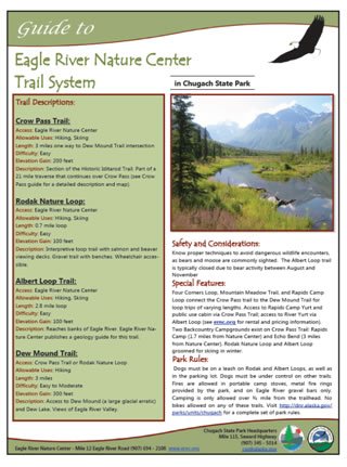
 Alaska State Parks Trail Guides provide a variety of information about a particular trail or trails. Guides provide access, difficulty, length, and use information. A trail profile illustrates the changes in elevation along the trail. A trail description and image describes the character, special features of the trail, and safety considerations. Also provided is information on park rules and contact information for a particular park area. Page two of the guide provides a detailed trail map for use as spatial reference. Park Visitor Centers may provide limited copies of the guides. Additionally, the maps are available here as pdf files, and can be printed for reference while on the trail.
To open pdf files, you must have Adobe Acrobat Reader version 5.0 or higher on your computer. Acrobat Reader is available for free off the Internet. Click the Get Acrobat button to ![]() go to the Adobe Acrobat web site, follow the instructions and choose the appropriate type of Acrobat Reader for your computer. The maps are large and may take time to download and copy.
go to the Adobe Acrobat web site, follow the instructions and choose the appropriate type of Acrobat Reader for your computer. The maps are large and may take time to download and copy.
Click on the links below for a trail map.
Chugach State Park
Denali State Park
K'esugi Ridge Trail System North |
Hatcher Pass East Management Area
|
Kachemak Bay State Park
Kodiak Area Parks
Shuyak Island Trail Map
Shuyak Island Kayak and Packrafting Routes
Caines Head State Recreation Area
Chena River State Recreation Area
Angel Creek Hillside and Winter Trail |
Compeau Trail & Colorado Creek Winter Trail |

