Northern Region
Lower Chatanika River State Recreation Area
Facilities
★ ADA Faciliy - Yes
★ 400 Acres
★ Olnes Pond Campground
★ Whitefish Campground and boat launch
Useful Links:
Lower Chatanika ATV Trail Map Brochure
Activities
★ Camping
★ Fishing
★ Picnicking
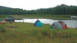
The Lower Chatanika State Recreation Area encompasses approximately 400 acres at mile 10.5 of the Elliot Highway. Developed sites within the recreation area include Olnes Pond and Whitefish campgrounds.
The Lower Chatanika recreation area provides access to the Chatanika River and an abundance of recreational opportunities including: Camping, Fishing, Picnicking, Hiking, Berry Picking, Boating/Floating, ATV/Snowmachining, Ice Fishing, Dog Sledding, Night Sky Viewing, and Cross Country skiing to name a few.
Address:
Mile 11 Elliott Highway
Driving Directions:
From the George Parks Hwy, this turns into the Robert Mitchell Expy, exit Steese Hwy, this will turn into the New Steese Hwy. Stay on Steese, this will turn into the Elliott Hwy. Located at milepost 11 of the Elliott Hwy.
From the Richardson Hwy, exit Steese Hwy, this will turn into the New Steese Hwy. Stay on Steese, this will turn into the Elliott Hwy. Located at milepost 11 of the Elliott Hwy.


