
Martin
Martin
6 land parcels are currently available for sale.


Parcel 498 - 1105
Acres: 6.37
Road Access
Lot: 12
Block: 1
Parcel 498 - 1106
Acres: 5.482
Road Access
Lot: 8
Block: 3
Parcel 498 - 1107
Acres: 3.696
No Road Access
Lot: 10
Block: 7
Parcel 498 - 1108
Acres: 4.04
No Road Access
Lot: 20
Block: 7
Parcel 498 - 1109
Acres: 3.96
No Road Access
Lot: 21
Block: 7
Parcel 498 - 1110
Acres: 5.836
No Road Access
Lot: 32
Block: 7
Attention
Parcel 1105: As a condition of sale, the apparent high bidder must sign an affidavit acknowledging the condition of the land and releasing the State from related liability due to the presence of potential hazards. This affidavit must be signed by all bidders and notarized. This affidavit must be received at DNR’s
Anchorage or Fairbanks offices by the auction paperwork deadline of 4:00 p.m., Thursday, December 10, 2026. As with all parcels, DNR recommends prospective bidders personally inspect all parcels before placing a bid.
Location
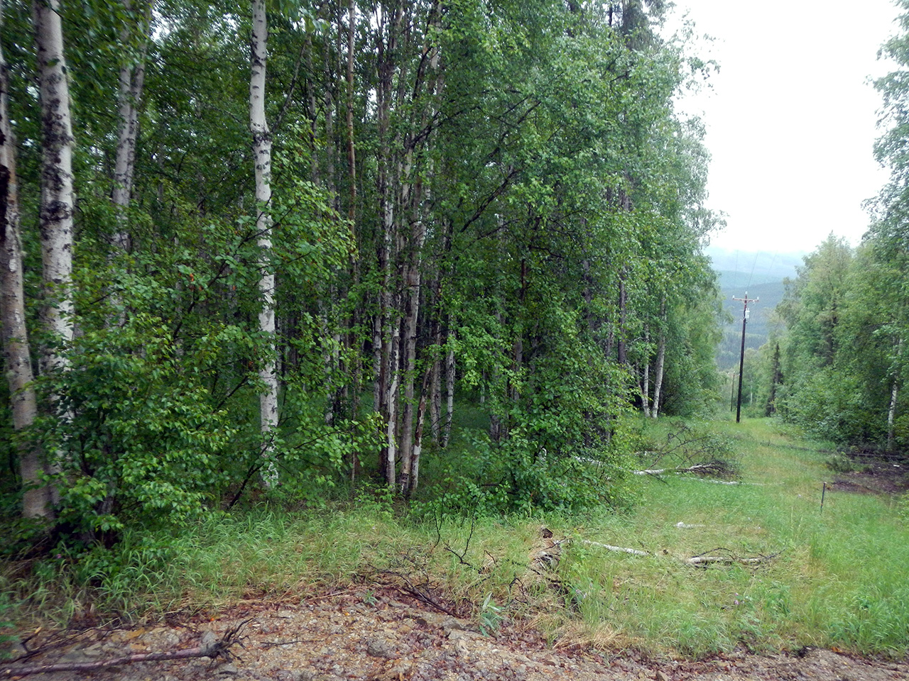
Martin is located on the south side of Old Murphy Dome Road, about 25 miles northwest of Fairbanks.
Access Details
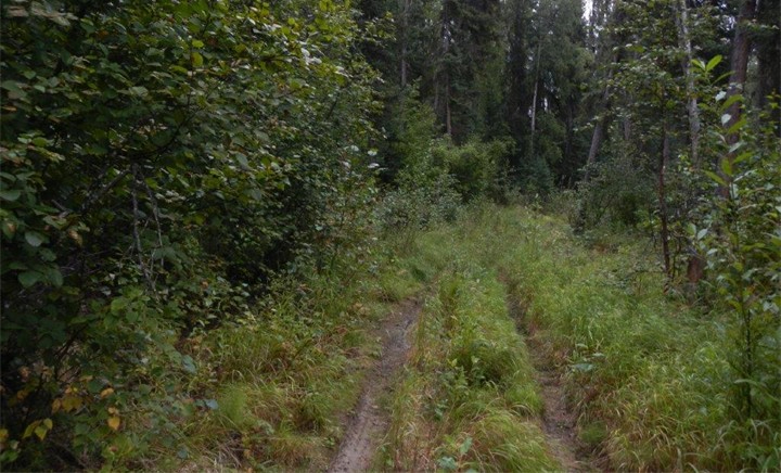
Access is from Old Murphy Dome Rd to High Sierra Dr. High Sierra Dr is a partially constructed gravel road, which becomes an ATV trail before the intersection with Matterhorn Dr (a partially developed ATV trail).
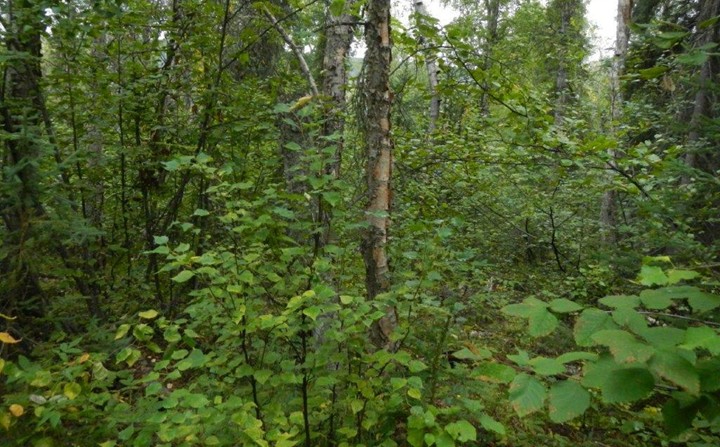
Parcels 1105 & 1106 are accessed from Cascade Rd (dirt/gravel road). Parcels 1107 – 1110 are accessible via ATV or walk-in. Parcels 1108 & 1109 are accessed from Matterhorn Dr to Wind River Rd (ATV trail). Parcel 1107 is accessed from Matterhorn Dr to Cumberland Ct (ATV trail). Parcel 1110 is accessed from High Sierra Dr, however, High Sierra Dr deteriorates to an overgrown ATV trail before reaching the parcel. During the most recent field inspection there were multiple trees fallen across the trail and the parcel was limited to walk-in access.
Utilities
There is no municipal water supply or sewer system. Please see plat notes and the Sewer and Water section of this brochure for details. Overhead electricity is available along Cascade Rd. There are no other utilities (electric, phone, internet, etc.) currently in this area.
Local Government
Martin is within the boundary of the Fairbanks North Star Borough and is subject to applicable platting authority, local ordinances and property assessments. Local ordinances may impose setbacks, easements, or restrictions in addition to those mentioned under Restrictions below. Please check with the borough for details of current ordinances.
Martin subdivision zoned Rural Estate (RE-4) by the Fairbanks North Star Borough. Please contact the borough for details.
Fire
This area is in the Critical Fire Management Option. See the Wildland Fires and Burn Permits section of this brochure for details.
Notes
These parcels may contain wetlands. Purchasers must obtain permits from the U.S. Army Corps of Engineers before developing any wetland areas.
Parcel 1105 (ADL 412883) was originally sold through the 1986 Lottery Program. In 1993 the property reverted back to State ownership. There is a dilapidated structure on the property. The structure is primarily concrete cinder blocks. It is incomplete and structurally unsound. In 2024 the parcel underwent clean up to remove nine 55-gallon drums, as well as the contaminated leaf litter and soil surrounding them. The drums contained waste oils and/or contaminated water. One drum contained waste determined to be hazardous per the EPA’s Resource Conservation and Recovery Act.
No additional toxic material, waste, or hazards were observed during the clean up or subsequent field inspections. DNR MAKES NO WARRANTIES AS TO THE “NONEXISTENCE” OF CONTAMINATION NOT NOW IDENTIFIED. STATE RECORDS ARE NOT A WARRANTY AS TO ALL POTENTIAL CONTAMINATION.
As a condition of sale, the apparent high bidder must sign an affidavit acknowledging the condition of the land and releasing the State from related liability due to the presence of potential hazards. This affidavit must be signed by all bidders and notarized. This affidavit must be received at DNR’s Anchorage or Fairbanks offices by the auction paperwork deadline of 4:00 p.m., Thursday, December 10, 2026. As with all parcels, DNR recommends prospective bidders personally inspect all parcels before placing a bid.
Restrictions
Easements affecting these parcels, as depicted on the plat, may include, but are not limited to, utility and public access easements. Information on restrictions, easements, reservations, and setbacks may be depicted on the plat, contained in the plat notes, or recorded separately. All parcels have a 30ft public utility easement adjacent to rights-of-way & a 15ft utility easement.
Parcel 1106 has a 10ft public non-motorized trail easement along the east lot line.
Survey and Appraisal
Martin is survey ASLS 84-21, located in Sections 5 & 6, Township 1 North, Range 3 West, and Sections 31 & 32, Township 2 North, Range 3 West, Fairbanks Meridian. The survey has been recorded as plat 84-275 in the Fairbanks Recording District; also see associated easement vacation plat EV-2- 306 recorded as Plat No. 84-274.
Right-of-way Status
The rights-of-way within the subdivision are partially developed. High Sierra Dr is a partially developed gravel road that deteriorates into an ATV trail. Cascade Rd is a dirt/gravel road. Matterhorn Dr is a partially developed ATV trail. Wind River Rd and Cumberland Ct are ATV trails.