Public Access Assertion and Defense
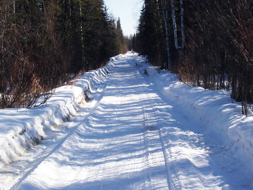
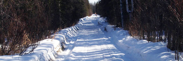
RS 2477 Trails Program
Background
Revised Statute 2477 (RS 2477) was a congressional grant of rights of way which provided: "The right of way for the construction of highways over public lands, not reserved for public uses, is hereby granted."
RS 2477 was repealed in 1976 which marked a dramatic departure from previous federal land management policy. However, RS 2477 rights-of-way that existed at that date expressly remained as valid existing rights. As a result, there are thousands of RS 2477 rights-of-way across the western United States and Alaska which, as Congress intended, provide an important support for regional transportation networks. In Alaska, these rights-of-way continue to play an essential role in accessing State, Federal, Native Corporation, and private lands throughout Alaska. To date, the Department of Natural Resources (DNR) has researched over 2,500 routes and determined that over 650 qualify as RS 2477 rights-of-way.
What are RS 2477 Rights-of-Way?
RS 2477 was a self-executing grant, meaning that acceptance of the grant required no formal process or action by the federal government, but rather the grant automatically took effect once certain conditions were met. A RS 2477 right-of-way comes into existence in Alaska automatically if a "public highway" was established across vacant, unreserved, unappropriated lands according to Alaska law.
In order to complete the grant, there must have been an act that constitutes acceptance. Acceptance occurs either by a positive act on the part of the appropriate public authorities, clearly manifesting an intention to accept a grant, or by public use for such a period of time and under such conditions as to indicate that the grant has been accepted. Expenditure of public money for construction or maintenance is often used as evidence of acceptance, but is not required. If the facts show that the right-of-way was accepted while the underlying property was unreserved federally owned land, the federal government granted the rights-of-way to the State of Alaska without any official administrative action.
RS 2477 rights-of-way are similar to many other easement types. The public has the right to use the right-of-way within the scope of the grant, but has no right to exceed that use. The underlying land owner may use the land co-located with the route, but may not interfere with the reasonable use of the rights-of-way.
The underlying property owner may not restrict the "reasonable and necessary" use as measured in light of traditional uses and purposes of the right of way. Additionally, federal land managers may be able to "reasonably regulate" the right of way consistent with federal regulations within their jurisdiction. Use of the land outside the right-of-way or beyond its scope could constitute trespass on private land or violate local, state or federal regulations on public land. The RS 2477 right-of-way may be maintained, to the extent reasonably necessary to ensure safe use consistent with its intended purpose. Many maintenance activities require authorization by DNR or the Department of Transportation (DOT).
While RS 2477 rights-of-way must be established on unreserved federal land, once the grant is accepted it remains regardless of who the underlying land is passed onto.
DNR Adjudication of RS 2477 Rights-of-Way
There have been several phases during which the State of Alaska has sought to identify RS 2477 rights-of-way across the state. Since 1993, DNR has received varying levels of funding to pursue the research and adjudication for RS 2477 rights-of-way. This program identifies and defends routes throughout the state that appear to qualify as valid public rights-of-way under RS 2477.
To successfully document an RS 2477 right-of-way on a historic route, the route must be shown to have constructed or used when the land was unreserved federal land.
DNR tracks research into RS 2477 rights-of-way by assigning a RST number and creating an associated file. As new routes are identified, new RST file numbers are created. Routes given an RST number are not necessarily a valid RS 2477 right-of-way. The RST number is simply for tracking purposes.
Typical RST documentation may include any of the following documentation occurring before January 17th, 1969 or when the land was otherwise unreserved federal land:
- U.S. Geological Survey bulletins, reports, field notes, and maps
- Aerial Imagery
- Alaska Road Commission annual reports and maps
- U.S. Postal Service contracts, site reports, and maps
- Territorial or state records showing expenditure on a route
- Other publications (books, newspapers, magazines)
- Personal use accounts
- Land title records prior to January 17th, 1969
If you need general information about RS 2477, the statute changes, or questions about a particular route, contact:
Alaska Department of Natural Resources
Public Information Center
550 W 7th Ave, Suite 1360
Anchorage, AK 99501
(907) 269-8400
Request for RS 2477 Trail Information
The State of Alaska Public Access Assertion and Defense needs your assistance to help preserve public access on Alaska roads and trails.
Do you have personal knowledge of historical use of a road or trail in Alaska before January 17th, 1969? If so, please share that information with us using the Alaska Trail Use Information Form
The information below is needed, if available:
- Local name of the trail, if established.
- A description or depiction of the route's physical location; including a starting point, general location, prominent locations along the way, and ending point. This information can also be shared by providing a GPS track or by tracing the route on a map or satellite imagery.
- Identify the type of travel that occurs along this route (foot, dogsled, ATV, snowmachine, highway vehicle, etc.).
- Describe your personal use of this trail including purpose, time of year, and frequency.
- Describe any known historic or current use of this route such as; hunting, fishing, mining, subsistence, property access, or other outdoor activities.
- Describe which seasons of the year the route is used.
- Finally, please provide your name, mailing address and phone number so that we may contact you for further information.
Alaska DNR encourages you to do personal research and share evidences that supports the establishment of a R.S. 2477 right of way. Please be aware that limited resources mean DNR must prioritize RS 2477 right-of-way investigations on a case-by-case basis. If your R.S. 2477 nomination is time sensitive or if access to a route is required in a timely manner, we encourage you to seek a personal attorney to assist with your concerns.
Thank you for helping to keep Alaska's historic trails open to the public!