Parcel Detail
Attention - Residency Requirements
Only Alaska residents may submit bids in the Sealed-Bid Auction.

Parcel 496 - 1033
Acres: 6.97
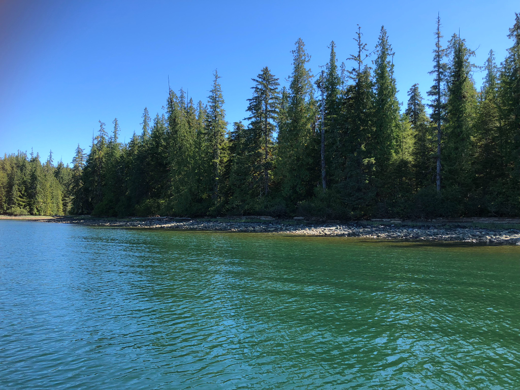
No Road Access
Lot: 23
Case File
Veteran Discount
The State of Alaska offers qualified Alaska resident veterans a once-in-a-lifetime discount on the purchase of state land.
Estimated Veteran Price: $70,561.86
This veteran's price is based on the minimum bid. When placing your bid, you will be bidding a non-discounted price. The actual discounted price based on your bid will be calculated using the method detailed in the brochure, if you qualify for the program and win the parcel.
Location
Lil’ Coal Bay is located approximately 8.5 miles east-northeast of the ferry dock in Hollis, and 2.5 miles south of the marina in Kasaan.
Meridian Township Range Section (MTRS): C073S085E25
Access Details
Access is by boat or floatplane from Kasaan Bay & Little Coal Bay. An existing launch ramp and unmaintained US Forest Service (USFS) road provide access to parcels without water frontage. Baker Point Rd is undeveloped.
Utilities
There is no municipal water supply or sewer system. Please see the Sewer and Water section of this brochure for details. There are no utilities (electricity, phone, internet, etc.) currently in this area.
Local Government
This subdivision is not within the boundaries of an organized borough. It is located within the Unorganized Borough and is subject to the State of Alaska platting authority.
Fire
This area is in the Modified Fire Management Option. See the Wildland Fires and Burn Permits section of this brochure for details.
Notes
Per the USFS, National Forest System (NFS) Road No. 2020000 may be used by purchasers for personal access to reach homes and utilize property. The USFS has no plans to maintain the road in the future. Uses of the road beyond personal access, such as snow plowing, road maintenance, driveway construction, etc., may require prior approval from USFS. Please contact DNR Land Sales for details. NFS Road No. 2020000 does not connect to the Prince of Wales Road system. The only remaining infrastructure from ADL 106000, a former USFS Log Transfer facility, is a launch ramp and stone retaining wall. The launch ramp provides public access to the subdivision as well as
Tongass National Forest. These parcels may contain wetlands. Purchasers must obtain permits from the U.S. Army Corps of Engineers before developing any wetland areas.
Restrictions
Easements affecting these parcels, as depicted on the plat, may include, but are not limited to, utility easements. Information on restrictions, easements, reservations, and setbacks may be depicted on the plat, contained in the plat notes, or recorded separately. All of the waterfront parcels have a 50ft public access easement from the ordinary high water line, as well as an additional 25ft building setback from the 50ft public access easement line. Lots with frontage along Baker Point Rd (undeveloped) have a 20ft public utility easement along the property line. See plat for details.
Survey and Appraisal
Lil’ Coal Bay is ASLS 2021-32, located in Sections 25, 26, & 35, Township 73 South, Range 85 East, Copper River Meridian. The survey has been filed as Plat 2023-9 in the Ketchikan Recording District.
Right-of-way Status
NFS Road No. 2020000 is an unmaintained and overgrown gravel road. Baker Point Rd is undeveloped.
Parcel Maps
View parcel with
Alaska Mapper Tool
Alaska Mapper User's Guide