
Tatalina II RRCS
Tatalina II RRCS
1 land parcel is currently available for sale.

Parcel 498 - 1126
Acres: 16.61
No Road Access
Tract: 19
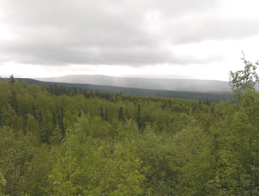
Location
Tatalina II is off the Elliot Hwy, approximately 25 miles south of the Elliot Hwy/Dalton Hwy intersection. Parcel 1126 is near milepost 47 of the Elliott Hwy, about a 1/4 mile west of the road.
Access Details
Access to the parcel is walk-in only along a section line easement, which is not brushed. From the Elliot Hwy (near milepost 47), travel approximately a 1/4 mile west, along the 100ft section line easement that runs along the boundary of Sections 12 & 13.
Utilities
There is no municipal water supply or sewer system. Please see plat notes and the Sewer and Water section of this brochure for details. There are no utilities (electric, phone, internet, etc.) currently in this area.
Local Government
This subdivision is not within the boundaries of an organized borough. It is located within the Unorganized Borough and is subject to the State of Alaska platting authority.
Fire
This area is in the Full Fire Management Option. See the Wildland Fires and Burn Permits section of this brochure for details.
Notes
This parcel may contain wetlands. Purchasers must obtain permits from the U.S. Army Corps of Engineers before developing any wetland areas.
This property is adjacent to a privately owned lot used for industrial/ construction related purposes. There is also a nearby material site used for gravel extraction. Potential purchasers should be aware of the possibility of additional traffic from trucks and heavy machinery, noise, and dust.
Restrictions
Easements affecting these parcels, as depicted on the plat, may include, but are not limited to, utility easements. Information on restrictions, easements, reservations, and setbacks may be depicted on the plat, contained in the plat notes, or recorded separately. There is a 30ft public access and utility easement along all lot lines. There is a 50ft section line easement that runs along the south lot line (the same easement which provides access to the parcel). Please see plat for
details. A driveway permit will be required from DOT&PF prior to construction of any driveway access from the Elliott Highway.
Survey and Appraisal
Tatalina II RRCS is survey ASLS 2016-12, located in Section 12, Township 6 North, Range 4 West, Fairbanks Meridian. The survey has been recorded as Plat 2018-52 in the Fairbanks Recording District.
Right-of-way Status
None. Legal access to the parcel is from the section line easement, which runs along the boundary of Sections 12 & 13.