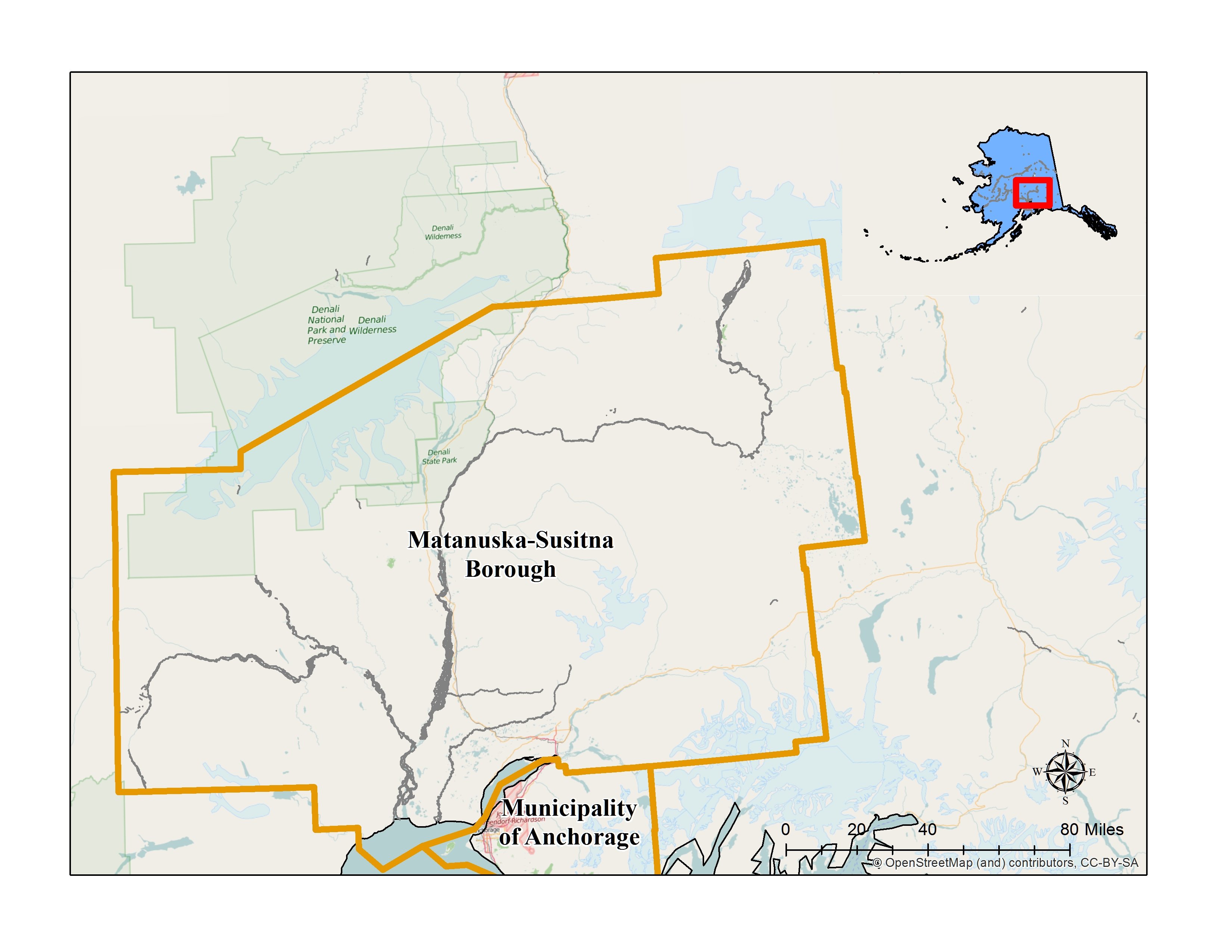
Matanuska Susitna Borough
2nd Class Borough
2015 Population: 104,166
Size: 25,259 Square Miles
Historical Preservation Commission: The goal of the Historical Preservation Commission is to promote and maintain cultural heritage and historic integrity within the Matanuska-Susitna Borough and to cultivate economic benefits through historic preservation. To do this we protect significant historic and prehistoric resources, material remains, writing and oral histories within the borough for the benefit of those in the present and future.
Date certified: 1987

-
CLG Grants
-
Historic Preservation Planning Grants
Historic Preservation Plan, Phase 1, 2019.
Willow, Houston, and Susitna Historic Preservation Plans. 2008.
National Heritage Areas Designation Study, Phase I, 2006; Phase II, 2007.
Protection of Palmer's Historic District: Matanuska Colony Historic District Design Guidelines. 2005. Preservation of the Palmer Historic District: Building the Future, Preserving and Enhancing the Matanuska Colony Historic District. 2004.
Historic Preservation Plan and Ordinance Review for the Matanuska-Susitna Borough. 2002.Survey and Inventory Grants
Cottonwood Creek Archaeological District: Survey and National Register nomination. 2013, 2015.
Middle Susitna Archaeological Survey and Inventory. 2012.
City of Wasilla Historic and Prehistoric Sites Survey. 2009.
Old Knik Townsite Survey, Evaluation, and Inventory. Phase I, 1997-1998, Phase II, 1999; Phase III, 2000; Phase IV, 2001.
Archaeological Survey and Inventory. 1995.
Chief Wasilla's House Site Survey and Inventory. 1994.
Homestead Sites in the Matanuska-Susitna Area Survey and Inventory. Phase 1, 1991; Phase II, 1993. Chickaloon and Carle Wagon Trails Evaluation of Sites. 1992.
Talkeetna Evaluation of Historic Sites. 1989.
Matanuska Coal Field Historic Contexts and Survey. 1988.
Palmer Evaluation of Historic Sites. 1987.National Register of Historic Places Grants
Palmer Agricultural Research Station Housing draft National Register nomination. 2010.
Talkeetna Historic District National Register Nomination. 1990.
The Settlement and Economic Development of Alaska's Matanuska-Susitna Valley Multiple Property National Register Nomination with individual nominations for the Community Center, Hyland Hotel, Bailey Farm, Patten Farm, Puhl House, Herried House, and Berry House. 1989.Historic Preservation Development/Predevelopment Grants
Rebarcheck Farm colony house stabilization, 2018.
Knik Pool Hall. 2010.Historic Preservation Education Grants
Wasilla Interpretive Signs. 2011.
Matanuska Colony Community Center Historic District Interpretive Signs and Brochure. Phase 1, 2001; Phase II, 2003.
Old Kinik Townsite Interpretive Signs. 2003.
Historic Preservation in the Matanuska-Susitna Borough Slide Show. 1992.
Major Coal Towns of the Matanuska Valley: A Pictorial History and Educational Curriculum. 1990.Commission Training Grants
National Alliance of Preservation Commissions Forum, 2017.
National Alliance of Preservation Commissions Forum 2014. 2014, 1999
CLG Workshop. 2001.
-
-
A Brief History
-
The borough boundaries are defined by two major rivers. The Susitna River cuts between the Alaska Range and Talkeetna Mountains, and the Matanuska River cuts between the Talkeetna and Chugach Mountain ranges. Athabaskans, particularly the Dena'ina and Ahtna people, traveled through the river valleys for thousands of years to fish, hunt, and trade with others. Evidence of their settlements, camps, and travel routes have contributed to understanding the people and where and how they lived. The Tangle Lakes Archaeological District at the eastern end of the borough's boundaries is a particularly rich area of archaeological sites.
Russian fur traders started making contact with Dena'ina people and exploring the two river valleys in the late 1700s. They did not establish permanent fur trading posts, but traders regularly came to several locations, including Knik and Susitna Station, to trade. American traders did the same after 1867. In the 1880s prospectors started venturing up the river valleys searching for gold and coal deposits. Placer gold was discovered in the 1890s in Willow Creek and lode gold in 1906 in Hatcher Pass. A number of hard rock gold mines operated in the Willow Creek Mining District until World War II. There was some mining activity after, and recreational mining today. In 1981 the State of Alaska purchased the buildings of the Independence Mine for a state historic park. The coal deposits in the Matanuska River valley had been of particular interest for development in the early 1900s. To reach the gold and coal mining areas, prospectors developed trails and roads, often incorporating trails the Dena'ina and Ahtna people had established. The supply center for the mining districts grew in the early 1900s around the Knik trading site at the head of Cook Inlet.
One of the reasons for selection of the Seward-Fairbanks route for the railroad the federal government decided to construct in Alaska was access to the Matanuska coal deposits for the U.S. Navy. The government built a spur from the main track and coal mining started at Chickaloon in 1916, but was abandoned a few years later. Along the main line, the Alaska Railroad platted several townsites, among them Wasilla and Talkeetna. The railroad bypassed Knik and the town was virtually abandoned as businessmen literally moved their buildings to Wasilla or Anchorage.
After its completion in 1923, the railroad worked with the Agricultural Extension Service to encourage people to homestead in the Matanuska and Susitna valleys. The campaign brought a few settlers, but it was the selection of the area in 1935 for a New Deal resettlement community that helped establish farms in the valley. The Matanuska Colony administrative center was placed where George Palmer had opened a trading post in 1916. The colony farms radiated out from it. There were design options for the farmhouses, barns and chicken coops on the individual 40 and 80 acre tracts. The administrative center with community and commercial buildings and an area with housing for the administrators, was designed around a quadrangle. Construction of a road between Anchorage and Palmer started when the colony was established, and during World War II it was extended to connect with the Richardson Highway, the principal road in the territory at the time. The road was named the Glenn Highway. Only in 1951 did the City of Palmer incorporate. Today, it is a center for agricultural research and administrative programs, and is the site for the largest of Alaska's state fairs.
Alaska's population increased dramatically after World War II. The Bureau of Land Management made land in the Matanuska and Susitna valleys open to veterans for homesteads. Construction of a major road to connect Anchorage and Fairbanks, generally paralleling the Alaska Railroad, started and the Parks Highway as it is known today was completed in the early 1970s. The road opened areas for recreational cabins and activities such as hunting, fishing, skiing, and sled dog racing. Mountain climbing, particularly of Denali (formerly Mt. McKinley), became a popular pursuit. Several air taxi services based at the small railroad station town of Talkeetna started transporting climbers to the Ruth Glacier to start their ascents, and the National Park Service opened a ranger station in the community.
The Matanuska-Susitna Borough, encompassing 25,259 square miles, incorporated in 1964. It has been the fastest growing area of the state for the last twenty years. Today, the population is around 89,000 people.
-
-
National Register of Historic Places Listings

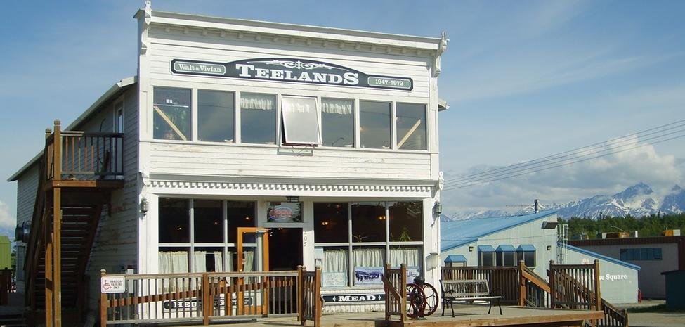
Tangle Lakes Archeological District (Boundary Decrease) Address Restricted Glennallen Palmer Depot AK 1 Palmer United Protestant Church S. Denali and Elmwood Sts. Palmer Independence Mines 7278 East Bogard Road Palmer Cunningham-Hall Pt-6,Nc-692W 3800 W Museum Dr, Wasilla, AK 99654 Palmer Rebarchek, Raymond, Colony Farm E. Rebarchek Ave Palmer Matanuska Colony Community Center E. Dogwood Ave Palmer Hyland Hotel 333 W. Evergreen Palmer Bailey Colony Farm 3150 N. Glenn Hwy. Palmer Patten Colony Farm Mi. 39.9 Glenn Hwy Palmer Puhl House 13151 E. Scott Rd. Palmer Herried House 4400 N. Palmer Fishook Rd. Palmer Berry House 5805 N. Farm Loop Rd. Palmer Campbell House 1540 Inner Springer Loop Palmer Sutton Community Hall Jonesville Rd. Sutton Kirsch's Place Mi. 1.5 Sunshine Rd./Mi. 215.3 Alaska Railroad Talkeetna Fairview Inn Main St., Talkeetna Talkeetna Curry Lookout Atop Curry Ridge, Mile 137.2, Parks Hwy. Talkeetna Talkeetna Historic District Roughly bounded by C, First, D and Front Sts. Talkeetna Talkeetna Airstrip Roughly from First St. S down D St. to the Susitna R. Talkeetna Wasilla Community Hall 215 Main St., Wasilla Wasilla Knik Site Mi. 15 Knik Rd., west of Wasilla Wasilla Wasilla Elementary School Off AK 3 Wasilla Teeland's Country Store Krazy Moose Subs Wasilla 405 E Herning Ave, Wasilla, AK 99654 Wasilla Depot Parks Highway and Knik Rd. Wasilla Tryck, Blanche and Oscar, House North Knik St., bet. the Parks Hwy/Alaska RR and E. Herning Ave. Wasilla Whitney Section House 3400 W. Neuser Dr. Wasilla

