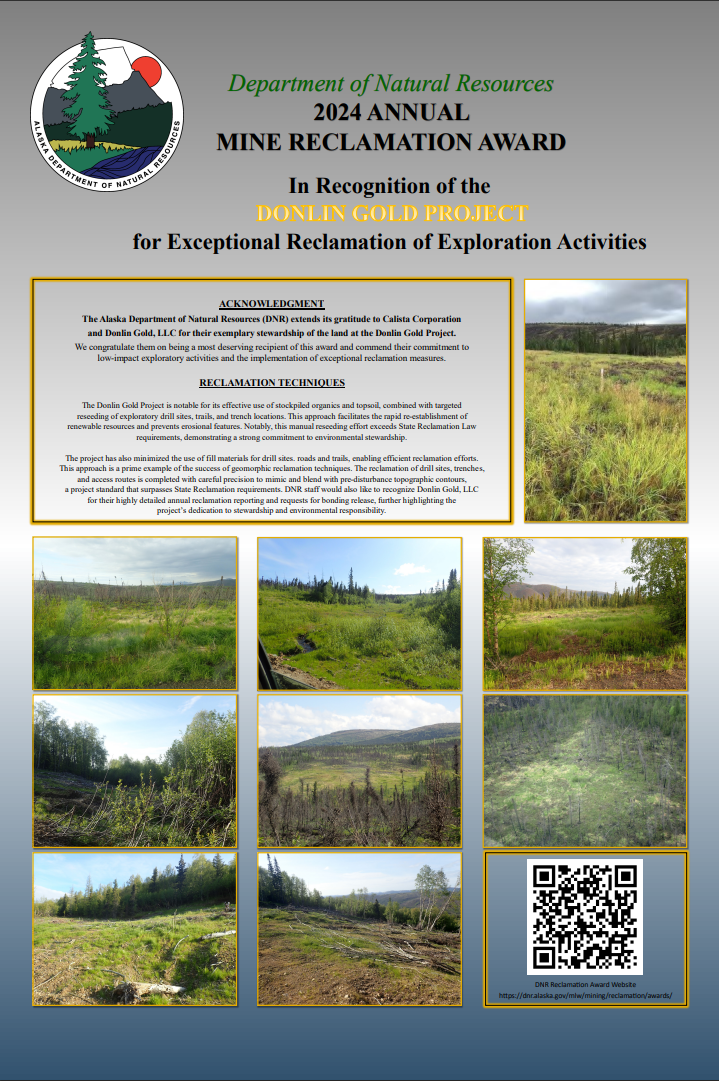
2024
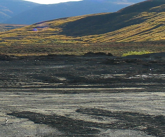
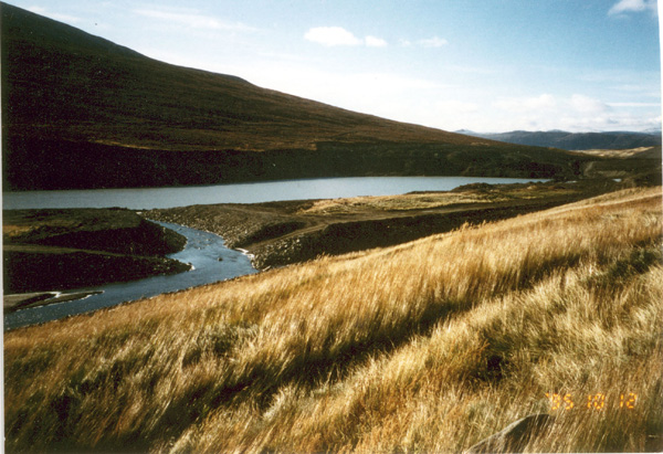
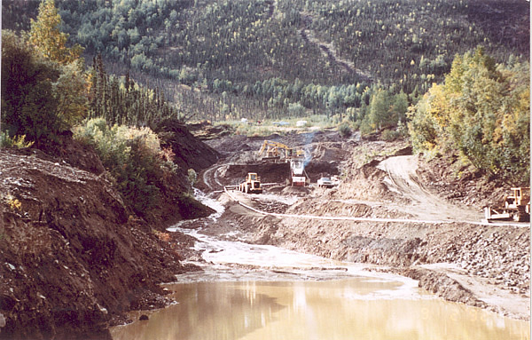
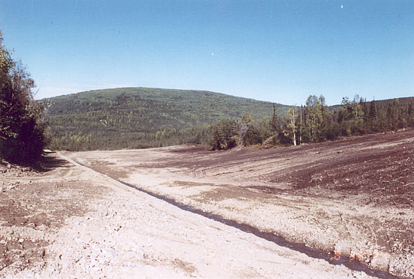
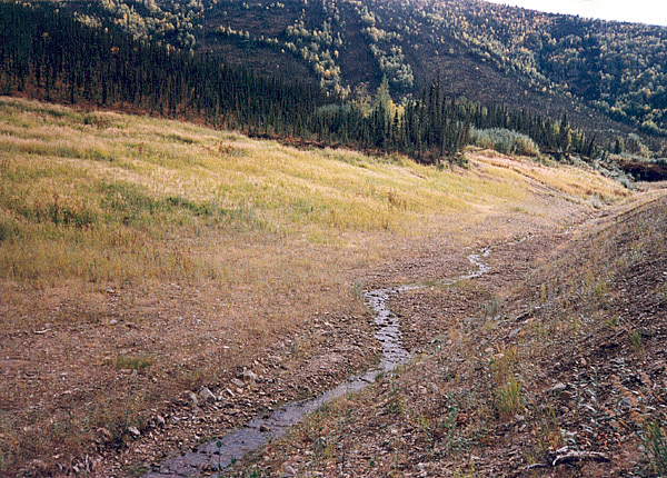
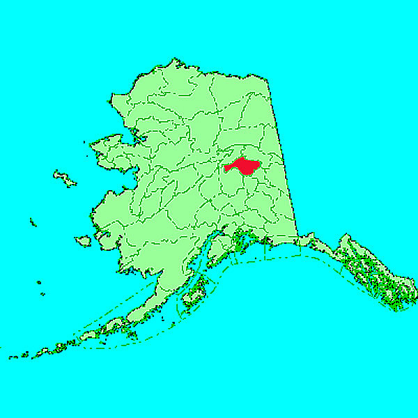
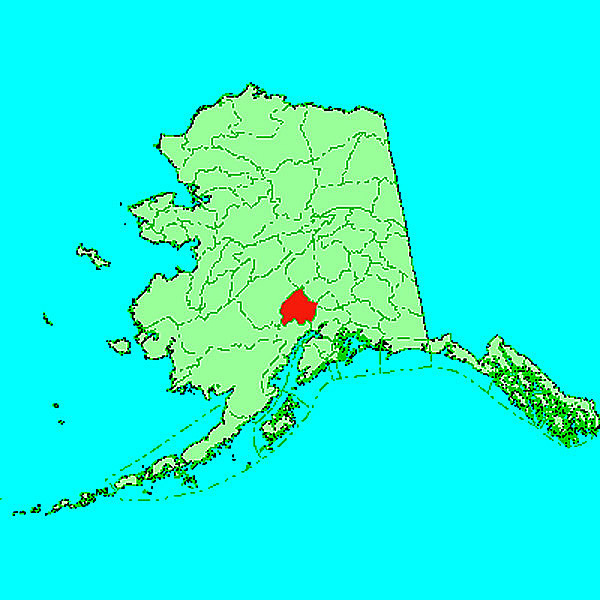
Donlin Gold Project
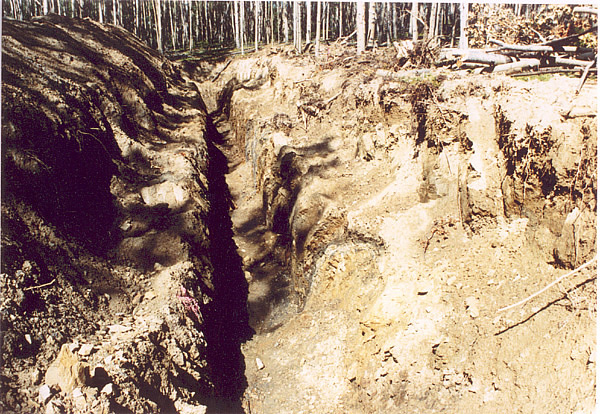
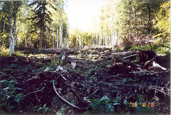
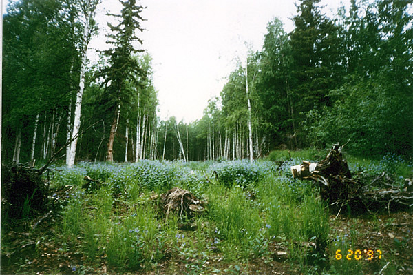
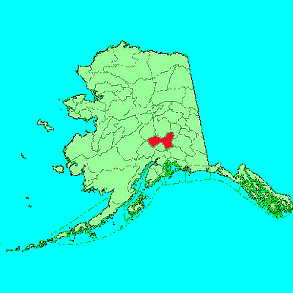
Area: Crooked Creek
Mining District: Aniak
Exceptional Reclamation of Exploration Activities
The Alaska Department of Natural Resources (DNR) extends its gratitude to Calista Corporation
and Donlin Gold, LLC for their exemplary stewardship of the land at the Donlin Gold Project.
We congratulate them on being a most deserving recipient of this award and commend their commitment to
low-impact exploratory activities and the implementation of exceptional reclamation measures.
The Donlin Gold Project is notable for its effective use of stockpiled organics and topsoil,
combined with targeted reseeding of exploratory drill sites, trails, and trench locations. This approach
facilitates the rapid re-establishment of renewable resources and prevents erosional features. Notably, this
manual reseeding effort exceeds State Reclamation Law requirements, demonstrating a strong commitment to
environmental stewardship.
The project has also minimized the use of fill materials for drill sites. roads and trails,
enabling efficient reclamation efforts. This approach is a prime example of the success of geomorphic reclamation
techniques. The reclamation of drill sites, trenches, and access routes is completed with careful precision to mimic
and blend with pre-disturbance topographic contours, a project standard that surpasses State Reclamation requirements.
DNR staff would also like to recognize Donlin Gold, LLC or their highly detailed annual reclamation reporting and
requests for bonding release, further highlighting the project's dedication to stewardship and environmental
responsibility.
You can see in the linked PDF the great success of the collaborative effort.
DNR Congratulates Calista Corporation and Donlin Gold, LLC as a most deserving recipient of this award.
2023
No awardee selected
2022
No nominations
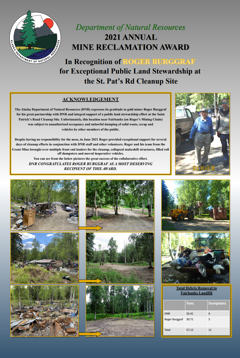
2021
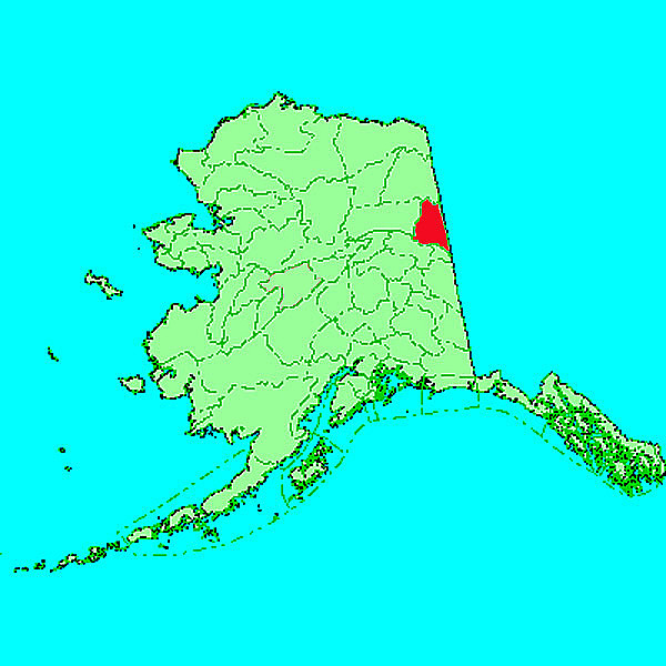
Roger Burggraf
Area: St. Pats Road
Mining District: Fairbanks (
Map)
Public Land Stewardship
The Alaska Department of Natural Resources (DNR) expresses its gratitude to gold miner Roger Burggraf
for his great partnership with DNR and integral support of a public land stewardship effort at the Saint
Patrick's Road Cleanup Site. Unfortunately, this location near Fairbanks (on Roger's Mining Claim)
was subject to unauthorized occupancy and unlawful dumping of solid waste, scrap and
vehicles by other members of the public.
The Fergusons took special care to create wetland
conditions by adding berms and depressions to reduce
the energy of a high-water event, allowing a stream to
overflow its banks and backflow into these areas. This
helps to redistribute soil over a floodplain and minimize
erosion.
Despite having no responsibility for the mess, in June 2021 Roger provided exceptional support for several
days of cleanup efforts in conjunction with DNR staff and other volunteers. Roger and his team from the
Grant Mine brought over multiple front end loaders for the cleanup, collapsed makeshift structures, filled roll
off dumpsters and moved inoperative vehicles.
You can see in the linked PDF the great success of the collaborative effort.
DNR Congratulates Roger Burggraf as a most deserving recipient of this award.
2020
No nominations
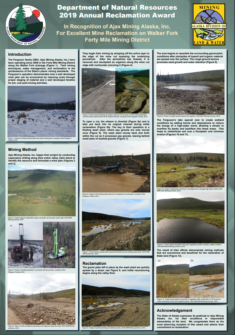
2019
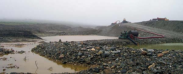
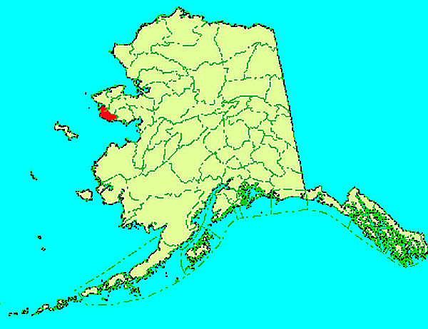
Ajax Mining, Alaska, Inc.
Drainage: Walker Fork
Mining District: Fortymile (
Map)
Placer Mining
The Ferguson family (DBA. Ajax Mining Alaska, Inc.) have
been operating since 2009 in the Forty Mile Mining District
along the Walker Fork drainage (Figure 1). Their mining
techniques, water management, and reclamation is the
quintessence of the State's placer mining standards. The
Ferguson's operation demonstrates how a well developed
mine plan can be economical by reducing costs through
proper staging of material and a well developed timeline
for pre- and post-mining activities.
The Fergusons took special care to create wetland
conditions by adding berms and depressions to reduce
the energy of a high-water event, allowing a stream to
overflow its banks and backflow into these areas. This
helps to redistribute soil over a floodplain and minimize
erosion.
The State of Alaska expresses its gratitude to Ajax Mining
Alaska, Inc. for their excellence in responsible
stewardship of the land. We congratulate them as the
most deserving recipient of this award and admire their
commitment to reclamation.
2018
No nominations
2017
No nominations
2016
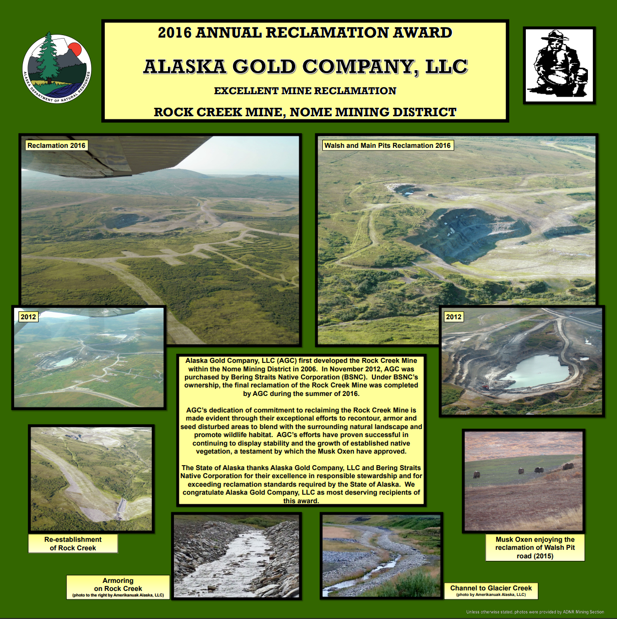
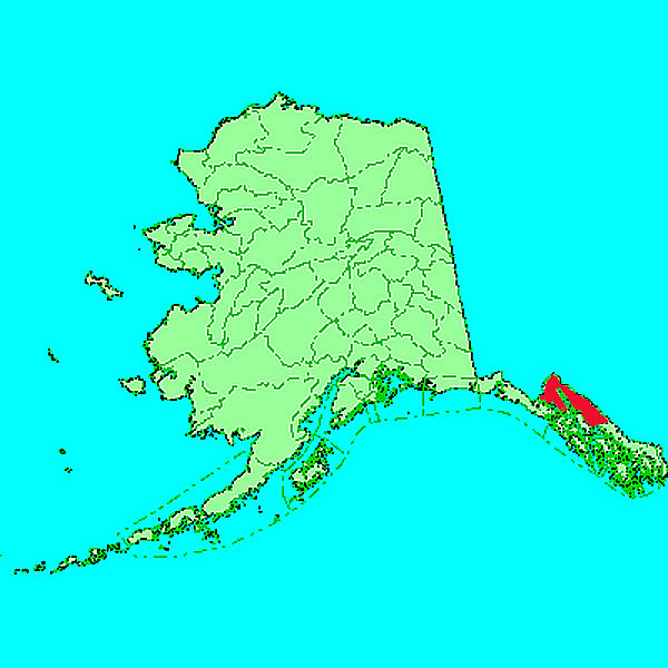
Alaska Gold Company, LLC. (a subsidiary of Bering Straits Native Corporation)
Area: Rock Creek Mine
Mining District: Nome (
Map)
Hardrock (Lode) Mining
Alaska Gold Company, LLC (AGC) first developed the Rock Creek Mine
within the Nome Mining District in 2006. In November 2012, AGC was
purchased by Bering Straits Native Corporation (BSNC). Under BSNC's
ownership, the final reclamation of the Rock Creek Mine was completed
by AGC during the summer of 2016.
AGC's dedication of commitment to reclaiming the Rock Creek Mine is
made evident through their exceptional efforts to recontour, armor and
seed disturbed areas to blend with the surrounding natural landscape and
promote wildlife habitat. AGC's efforts have proven successful in
continuing to display stability and the growth of established native
vegetation, a testament by which the Musk Oxen have approved.
The State of Alaska thanks Alaska Gold Company, LLC and Bering Straits
Native Corporation for their excellence in responsible stewardship and for
exceeding reclamation standards required by the State of Alaska. We
congratulate Alaska Gold Company, LLC as most deserving recipients of
this award.
2015
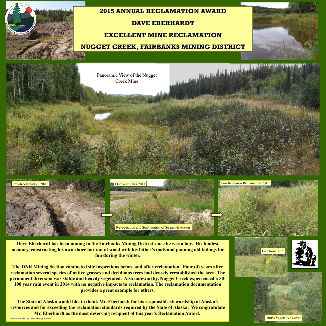
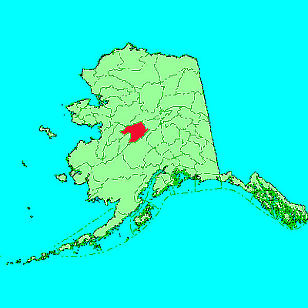
Dave Eberhardt
Drainage: Nugget Creek
Mining District: Fairbanks (
Map)
Placer Mining
Dave Eberhardt has been mining in the Fairbanks Mining District since he was a boy. His fondest
memory, constructing his own sluice box out of wood with his father's tools and panning old tailings for
fun during the winter.
The DNR Mining Section conducted site inspections before and after reclamation. Four (4) years after
reclamation several species of native grasses and deciduous trees had densely reestablished the area. The
permanent diversion was stable and heavily vegetated. Also noteworthy, Nugget Creek experienced a 50-
100 year rain event in 2014 with no negative impacts to reclamation. The reclamation documentation
provides a great example for others.
The State of Alaska would like to thank Mr. Eberhardt for his responsible stewardship of Alaska's
resources and for exceeding the reclamation standards required by the State of Alaska. We congratulate
Mr. Eberhardt as the most deserving recipient of this year's Reclamation Award.
2014
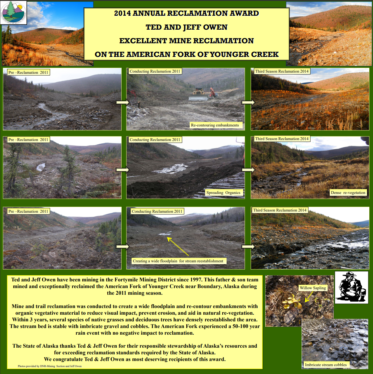
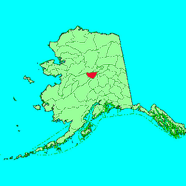
Ted & Jeff Owen
Drainage: American Fork of Younger Creek
Mining District: Fortymile (
Map)
Placer Mining
Ted and Jeff Owen have been mining in the Fortymile Mining District since 1997. This father & son team
mined and exceptionally reclaimed the American Fork of Younger Creek near Boundary, Alaska during
the 2011 mining season.
Mine and trail reclamation was conducted to create a wide floodplain and re-contour embankments with
organic vegetative material to reduce visual impact, prevent erosion, and aid in natural re-vegetation.
Within 3 years, several species of native grasses and deciduous trees have densely reestablished the area.
The stream bed is stable with imbricate gravel and cobbles. The American Fork experienced a 50-100 year
rain event with no negative impact to reclamation.
The State of Alaska thanks Ted & Jeff Owen for their responsible stewardship of Alaska's resources and
for exceeding reclamation standards required by the State of Alaska.
We congratulate Ted & Jeff Owen as most deserving recipients of this award.
2013
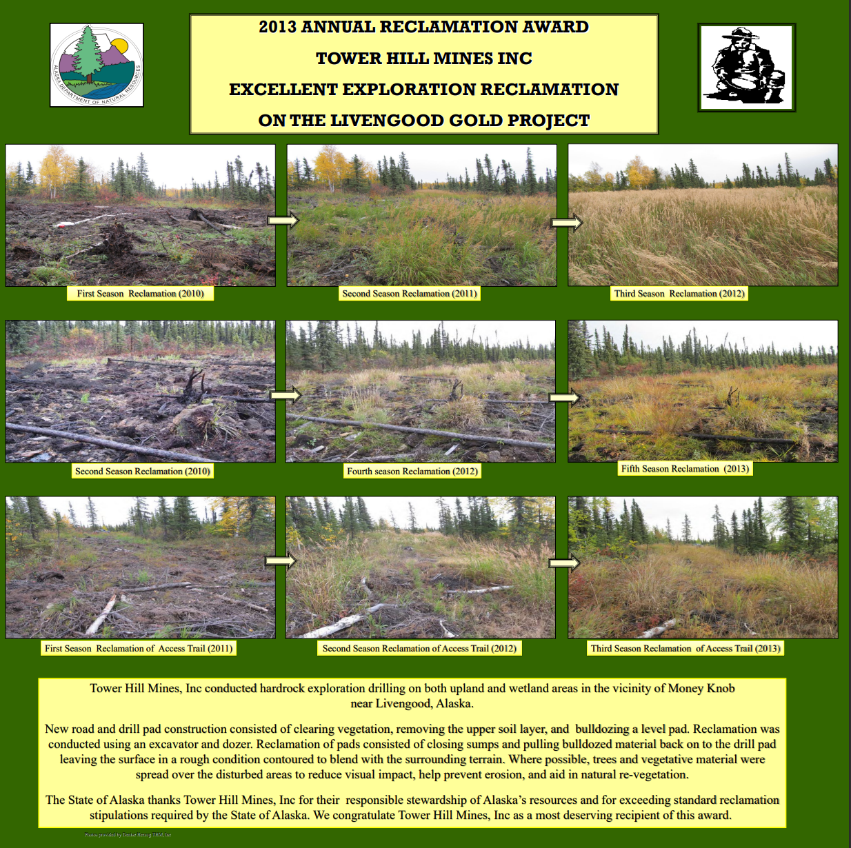
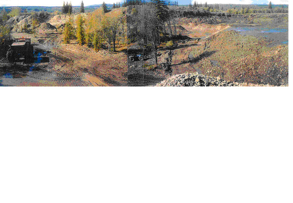
Tower Hill Mines, Inc.
Area: Livengood Gold Project
Mining District: Tolovana
Hardrock Exploration
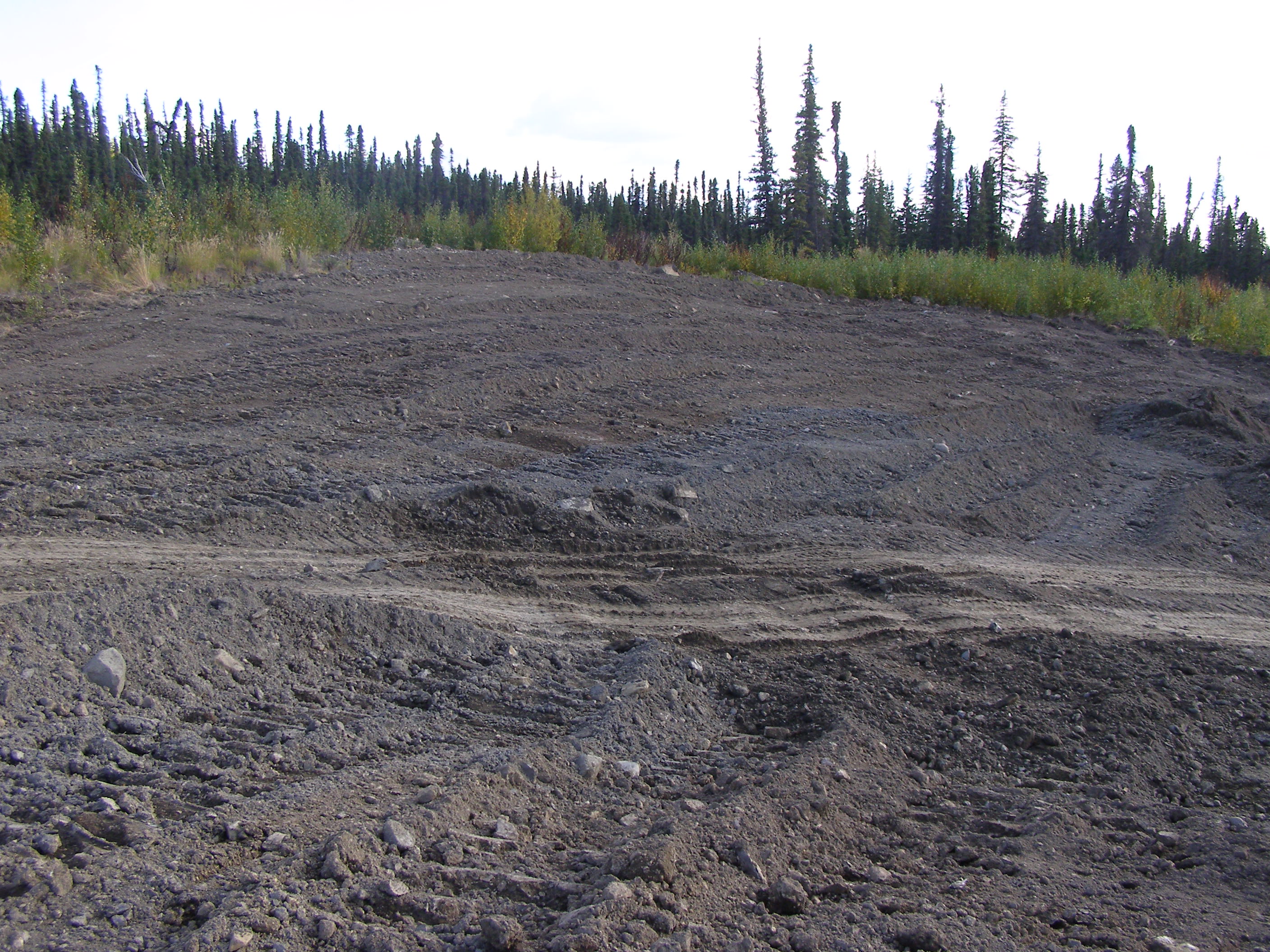
Tower Hill Mines, Inc conducted hardrock exploration drilling on both upland and wetland areas in the
vicinity of Money Knob near Livengood, Alaska.
New road and drill pad construction consisted of clearing vegetation, removing the upper soil layer,
and bulldozing a level pad. Reclamation was conducted using an excavator and dozer. Reclamation of pads consisted of
closing sumps and pulling bulldozed material back on to the drill pad leaving the surface in a rough condition contoured
to blend with the surrounding terrain. Where possible, trees and vegetative material were
spread over the disturbed areas to reduce visual impact, help prevent erosion, and aid in natural re-vegetation.
The State of Alaska thanks Tower Hill Mines, Inc for their responsible stewardship of Alaska's
resources and for exceeding standard reclamation stipulations required by the State of Alaska.
We congratulate Tower Hill Mines, Inc as a most deserving recipient of this award.
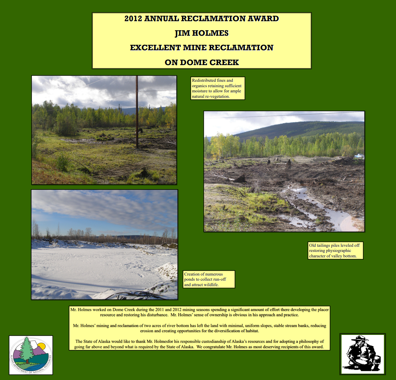
2012
Jim Holmes
Drainage: Dome Creek
Mining District: Fairbanks (
Map)
Placer Mining
Mr. Baker worked on Livengood Creek during the 2010 and 2011
mining seasons spending a significant amount of effort there
developing the placer resource and restoring his disturbance. Mr.
Baker's sense of ownership is obvious in his approach and practice.
Mr. Baker's mining and reclamation of five acres of river bottom has
left the land with minimal, uniform slopes, stable stream banks,
reducing erosion and creating opportunities for the diversification of
habitat.
The State of Alaska would like to thank Mr. Baker for his responsible
custodianship of Alaska's resources and for adopting a philosophy of
going far above and beyond what is required by the State of Alaska.
We congratulate Mr. Baker as most deserving recipients of this
award.
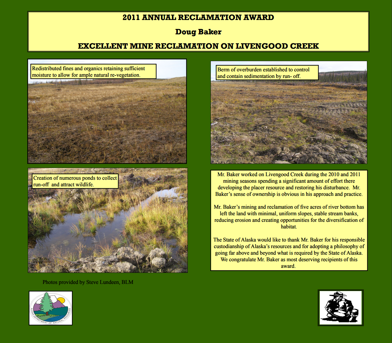
2011
Doug Baker
Drainage: Livengood Creek
Mining District: Tolovana
Placer Mining
Mr. Baker worked on Livengood Creek during the 2010 and 2011
mining seasons spending a significant amount of effort there
developing the placer resource and restoring his disturbance. Mr.
Baker's sense of ownership is obvious in his approach and practice.
Mr. Baker's mining and reclamation of five acres of river bottom has
left the land with minimal, uniform slopes, stable stream banks,
reducing erosion and creating opportunities for the diversification of
habitat.
The State of Alaska would like to thank Mr. Baker for his responsible
custodianship of Alaska's resources and for adopting a philosophy of
going far above and beyond what is required by the State of Alaska.
We congratulate Mr. Baker as most deserving recipients of this
award.
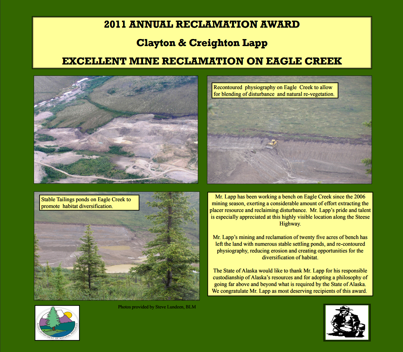
Clayton and Creighton Lapp
Drainage: Eagle Creek
Mining District: Circle (
Map)
Placer Mining
Mr. Lapp has been working a bench on Eagle Creek since the 2006
mining season, exerting a considerable amount of effort extracting the
placer resource and reclaiming disturbance. Mr. Lapp's pride and talent
is especially appreciated at this highly visible location along the Steese
Highway.
Mr. Lapp's mining and reclamation of twenty five acres of bench has
left the land with numerous stable settling ponds, and re-contoured
physiography, reducing erosion and creating opportunities for the
diversification of habitat.
The State of Alaska would like to thank Mr. Lapp for his responsible
custodianship of Alaska's resources and for adopting a philosophy of
going far above and beyond what is required by the State of Alaska.
We congratulate Mr. Lapp as most deserving recipients of this award.
2010
Barry Clay
Drainage: Swift Creek
Mining District: Ruby (
Map)
Placer Mining
2009
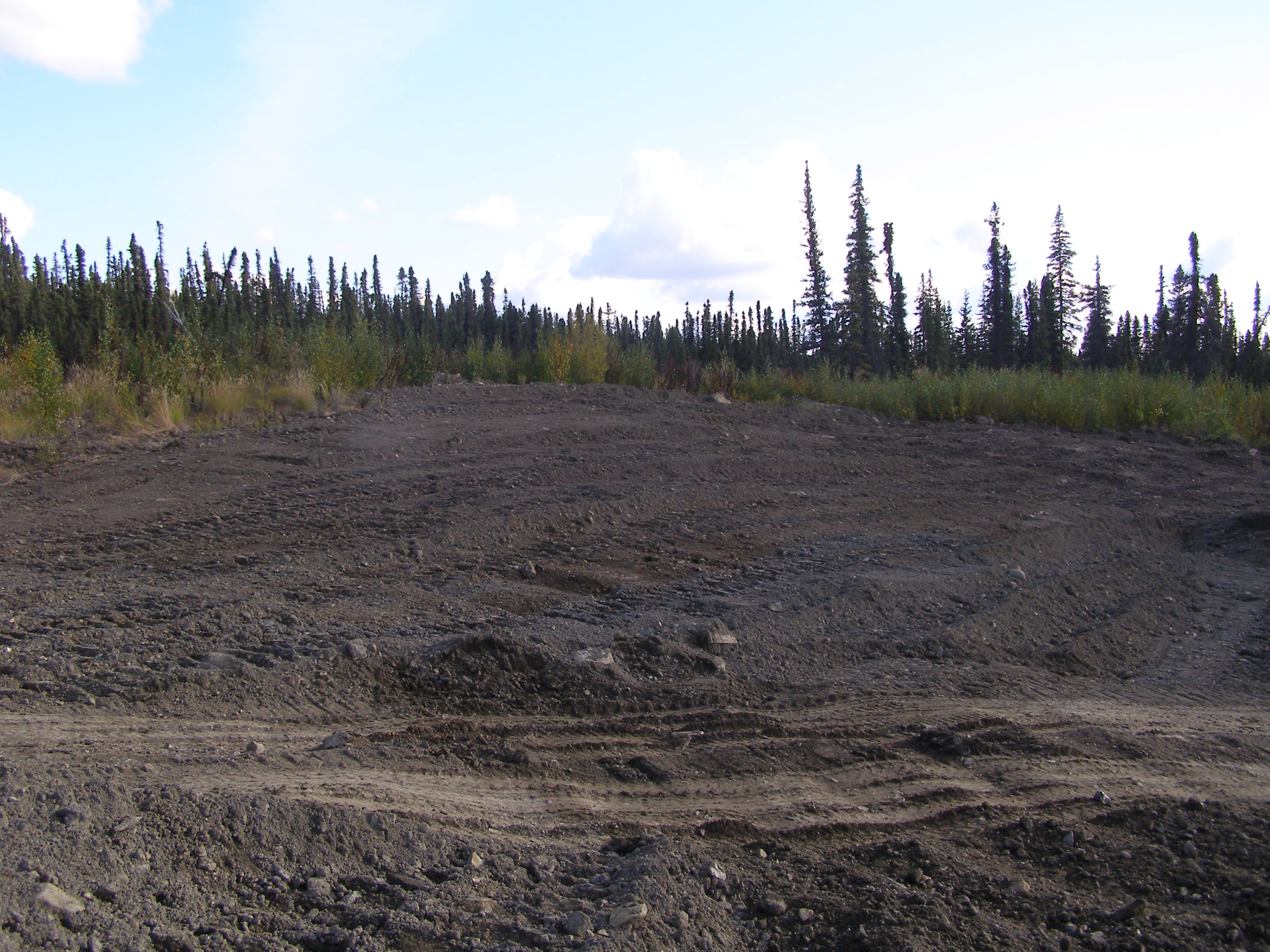
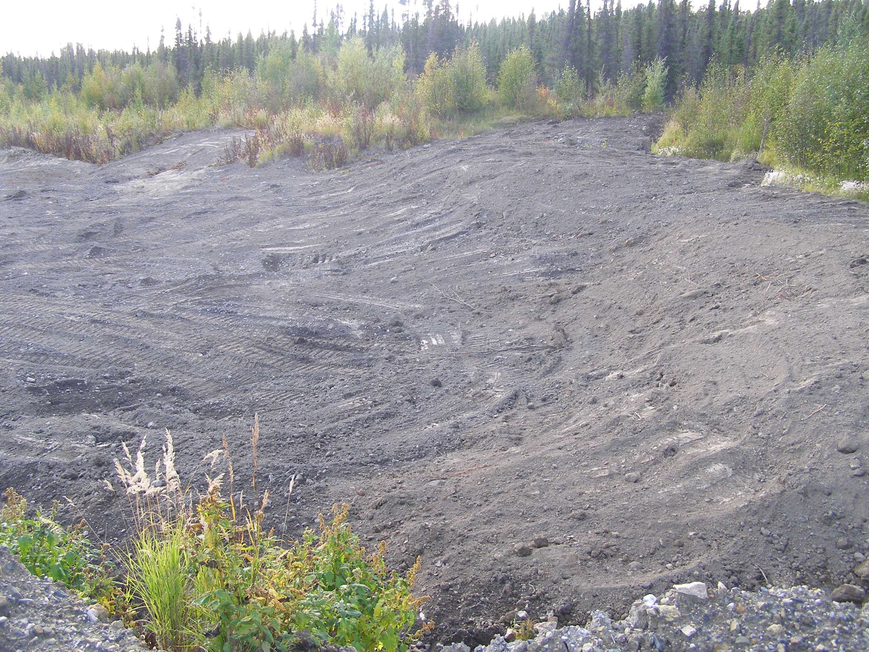
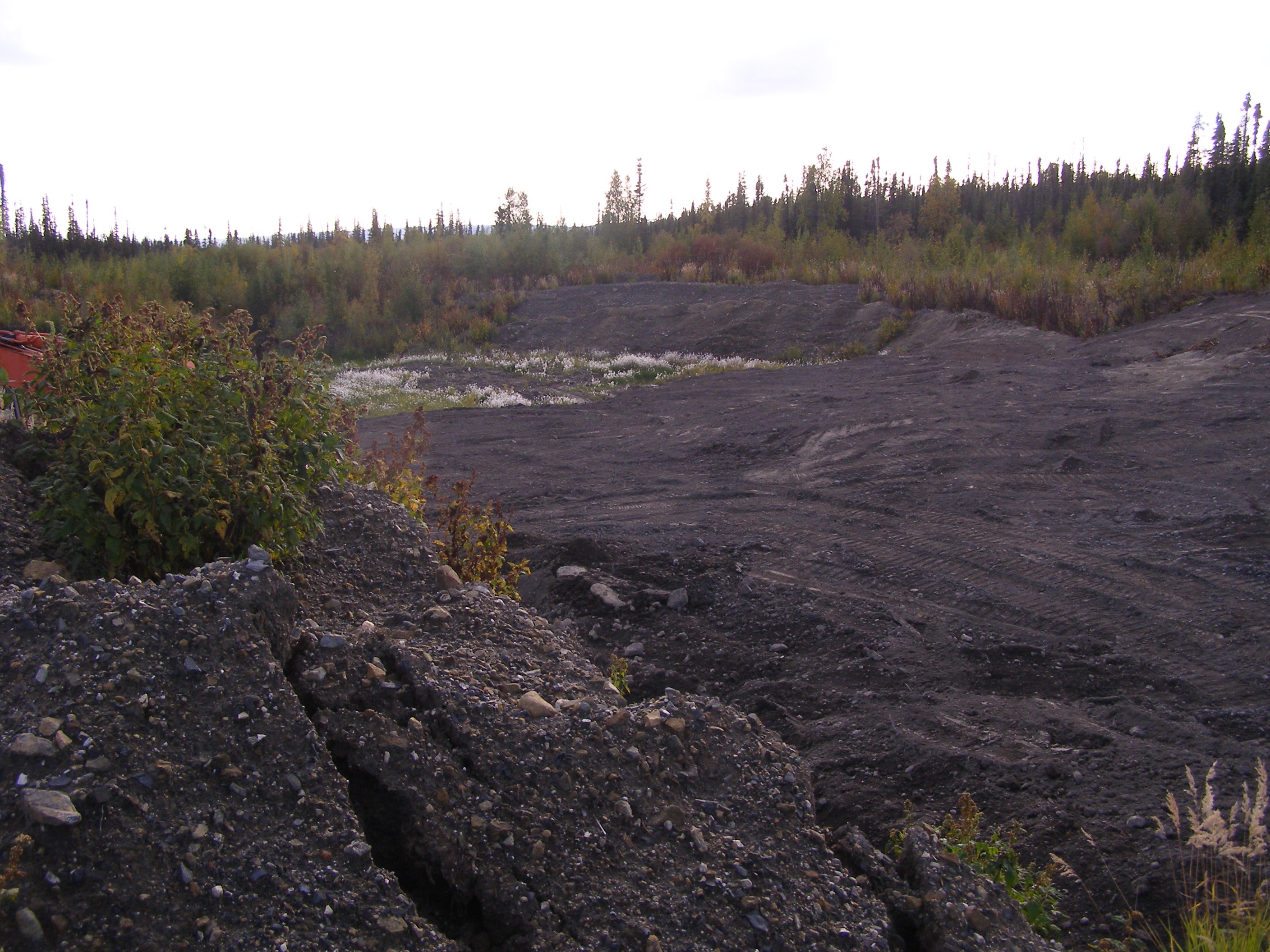
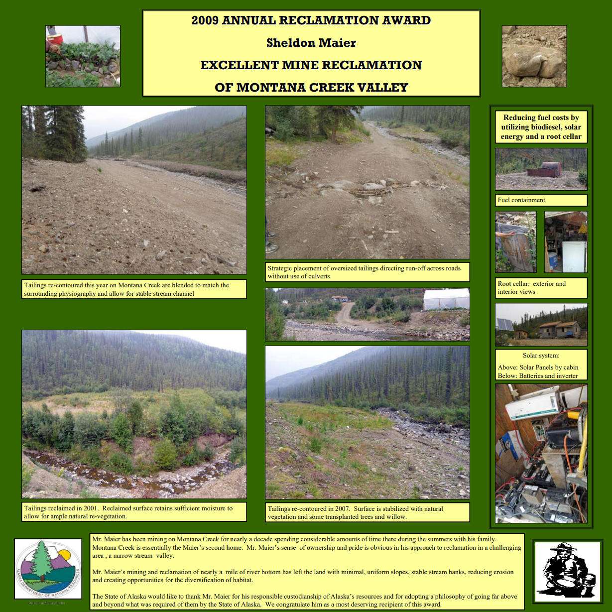
Sheldon Maier
Drainage: Glacier Creek
Mining District: Koyukuk
Placer Mining
Mr. Maier has been mining on Montana Creek for nearly a decade spending considerable
amounts of time there during the summers with his family. Montana Creek is essentially the Maier's
second home. Mr. Maier's sense of ownership and pride is obvious in his approach to reclamation in a challenging
area, a narrow stream valley.
Mr. Maier's mining and reclamation of nearly a mile of river bottom has left the land with minimal,
uniform slopes, stable stream banks, reducing erosion and creating opportunities for the diversification of habitat.
The State of Alaska would like to thank Mr. Maier for his responsible custodianship of Alaska's resources
and for adopting a philosophy of going far above and beyond what was required of them by the State of Alaska. We
congratulate him as a most deserving recipient of this award.
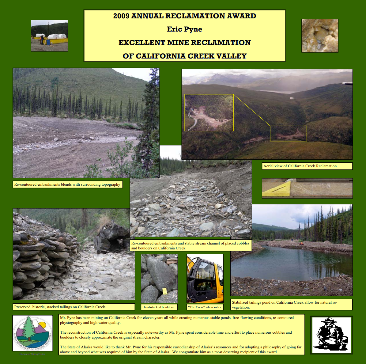
Eric Pyne
Drainage: Glacier Creek
Mining District: Koyukuk
Placer Mining
Mr. Pyne has been mining on California Creek for eleven years all while creating numerous stable ponds,
free-flowing conditions, re-contoured physiography and high water quality.
The reconstruction of California Creek is especially noteworthy as Mr. Pyne spent considerable time and
effort to place numerous cobbles and boulders to closely approximate the original stream character.
The State of Alaska would like to thank Mr. Pyne for his responsible custodianship of Alaska's resources
and for adopting a philosophy of going far above and beyond what was required of him by the State of Alaska. We
congratulate him as a most deserving recipient of this award.
Usibelli Coal Mining Co.
Area: Gold Hill
Mining District: Healy
Coal Mining
2008
Sam Koppenberg
Drainage: Faith Creek
Mining District: Circle
(
Map)
Placer Mining
2007
George Sueffert Jr.
Drainage: Chicken Creek
Mining District: Fortymile
(
Map)
Placer Mining
Jim Thurman
Drainage: Fairbanks and Alder Creeks
Mining District: Fairbanks
(
Map)
Placer Mining
2006
Tod Bauer-Goldorado Co.
Drainage: Gold Creek
Mining Districts: Valdez Creek & Yentna
Placer Mining
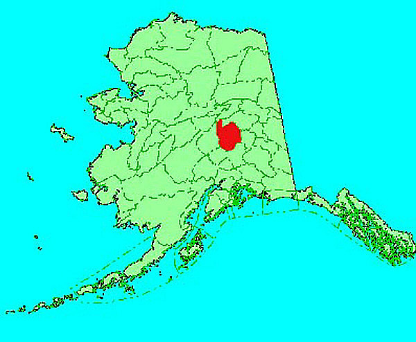
NYAC Mining/Calista Corp.
Drainage: Six Creeks in NYAC area
Mining District: Aniak
Placer Mining
Thurman-Earth Movers
Drainage: Fairbanks Creek
Mining District: Fairbanks
(
Map)
Placer Mining
2005
Les Maxwell & Forrest Hayden
Drainage: Kalamazoo and Squaw Creeks
Mining District: Fortymile
(
Map)
Placer Mining
2004
Mike Busby
Drainage: Chicken Creek
Mining District: Fortymile
(
Map)
Placer Mining
2003
Betty Krutzsch
Drainage: Specimen Gulch
Mining District: Nome
(
Map)
Betty Krutzsch operated a placer mine on Specimen Gulch in the Nome mining district during the 1989 - 2000 mining seasons.
She has been mining on patented mining claims and is recognized for outstanding reclamation work on approximately 30 acres of land.
Once mining was complete, the disturbed land was carefully re-countoured and overburden and topsoil were spread over the entire area.
The stream channel was reconstructed with an adequate floodplain that included sinuosity similar to the original stream.
Mrs. Krutzsch went beyond the minimum reclamation standards by hand seeding and fertilizing the area, as well as planting willow stakes
and live haul willow bundles to help reestablish natural vegetation.
These efforts have greatly reduced erosion and have enhanced rapid revegetation on the site.
Jim Conway and Sam Turner
Drainage: Pete's/Bird and Upper Cache Creeks
Mining District: Yentna
(
Map)
This Award recognizes outstanding reclamation work by Jim Conway and Sam Turner on Peter's/Bird and
Upper Cache Creeks near Petersville, Alaska in the Yentna mining district.
These placer miners completed reclamation work on State mining claims that
were abandoned over 10 years ago by the previous owners.
Reclamation work included disposing of by means of burial, several thousand tons of abandoned mining equipment,
including large empty fuel tanks and camp structures.
Several tons of scrap metal and usable equipment were removed and salvaged.
The willingness of these miners to work with agency personnel,
and their action in removing and disposing of the abandoned hazards was extremely helpful to the State of Alaska.
Steve Pomrenke
Drainage: Tripple Creek
Mining District: Nome (
Map)
This Award recognizes Steve Pomrenke's reclamation accomplishments on private mining claims that he operated near Nome, Alaska.
The reclamation work involved approximately 19 acres that were mined for placer gold between 1997 and 2002 on Tripple Creek in the Nome mining district.
Field reports and photo documentation by DNR staff show that his mining and reclamation efforts were done in a well-planned and organized manner.
Even after the reclamation was approved by DNR, he continued to work to satisfy his personal standard
of returning the land as close to pre-mining conditions as possible. This commitment to the State and the mining industry is exemplary.
The manner in which he reclaimed the mine will serve to promote rapid re-colonization of local native plants
and provide new post mining opportunities on Tripple creek. The overall result is a stable site that blends with the natural background.
2002
Ray Lester
Drainage: Birch Creek
Mining District: Circle (
Map)
Ray Lester has been mining on Birch Creek, in the Circle mining district since 1992.
This award recognizes reclamation of approximately 7 acres that were mined in the 1995 mining season.
Care was taken to level and contour overburden and tailings stockpiles to blend with the surrounding topography.
The stream channel was reconstructed with an adequate floodplain, similar to that of the original stream.
These measures will deter erosion and facilitate revegetation.
For his mining and reclamation efforts that went beyond normal reclamation standards,
Mr. Lester is a deserving recipient of a 2002 Annual Reclamation Award.
2001
Flint Wolff and Cy Bras
Drainage: Twelve Mile Creek
Mining District: Fortymile (
Map)
Flint Wolf and Cy Bras were recognized with a 2001 Award for Mined Land Reclamation for cleaning up a state mining claim
on Twelve Mile Creek near Boundary in the Fortymile mining district.
This mining claim has been inactive for approximately 10 to 15 years by absentee owners.
The reclamation work involved securing leaking fuel oil tanks and preventing the discharge of thousands of gallons
of fuel into the Fortymile River drainage system. They cat trained the large fuel tanks, a number of 55 gallon
drums of waste oil, and a D-8 dozer out of the steep Twelve Mile Creek drainage to Boundary Road for eventual salvage.
Work was accomplished after freeze up and was difficult to identify the route of travel by the following summer.
This commitment to the state and the mining industry is exemplary.
This is an example of placer miners willing to work with the DML&W and DEC's SPAR personnel without formal contracts to
respond quickly in removing the fuel and tanks preventing a final failure of the tank valves and discharge
of fuel into the river during spring breakup.
James Oudekerk
Drainage: Rex Creek
Mining District: Bonnifield (
Map)
James Oudekerk was recognized for excellent reclamation work on Rex Creek in the Bonnifield mining district.
The reclamation work involved approximately 3 acres that were mined for placer gold in 2001.
The mined area was recontoured and overburden was re-spread to induce natural revegetation.
This reclamation will allow for rapid re-colonization of local native plants within the Rex creek flood plane.
Mike Busby
Drainage: Chicken Creek
Mining District: Fortymile (
Map)
Mike Busby, owner of Geoquest was awarded the 2001Governor's Award for Mined Land Reclamation.
Mike has mined in the Fortymile mining district on Chicken Creek near Chicken for several years.
He has been mining on patented federal mining claims and is recognized for outstanding reclamation work on approximately 5 acres that had been mined for placer gold.
Field reports and photo documentation by DNR staff show that Mike's mining and reclamation efforts
were accomplished in a well-planned and organized manner. Even after reclamation was approved by DNR Mike
continued to go beyond the state standards in returning the land to a condition suitable for future use as an alternative business activity.
Mike has developed a gift shop and RV campground on his reclaimed ground and is in the process of restoring a bucketline dredge that operated on Chicken Creek.
Through Mike's efforts in preserving the historic dredge tourism and mining will be promoted by telling the "Story of Mining" in the heart of the Forty Mile Mining District.
2000
Kvaerner
Drainage: AJ Mine Closure
Mining District: Juneau (
Map)
Fairbanks Gold Mining
Drainage: Fish Creek
Mining District: Fairbanks (
Map)
Alaska Dept of Fish & Game
Drainage: Fish Creek
Mining District: Fairbanks (
Map)
1999
Wayne Gibson
Drainage: Golden Creek
Mining District: Melozitna (
Map)
1998
Jon Vander Wal
Drainage: Thistle Creek
Mining District: Bonnifield (
Map)
Jon Vander Wal conducted a placer mining operation on Thistle Creek in the Bonnifield Mining District during the 1994-1998 mining seasons.
He is this year's only Reclamation Award recipient.
This award comes as a result of a well-planned and executed mining program.
From the beginning, ponds, stream bypasses and material stockpiles were placed to facilitate reclamation.
Once mining was complete, the ponds were carefully drained; gravel overburden was used to cap the ponds and finally,
topsoil was spread over the entire area.
The stream channel was reconstructed with an adequate floodplain that included sinuosity similar to the original stream.
Mr. Vander Wal did not stop once he had achieved the minimum reclamation standards; he further secured the stream channel
by making the floodplain wider in some areas and completes additional recontouring to further blend the area with the surrounding topography.
1997
Ryan Lode Mines, Inc.
Drainage: Ryan Load Mine
Mining District: Fairbanks (
Map)
Ryan Lode Mines, Inc. is being recognized for reclamation conducted on the A-B-C-D heap leach pads and for
exploration trench closures on Ester Dome in the Fairbanks mining district.
The heaps were constructed in 1988 and 1989, and contained some 154,000 tons of ore stacked 22 feet high.
In 1996 the heaps were decommissioned, consolidated, seeded and fertilized.
By the fall of 1997, the revegetation program showed great success.
The net result is a pleasing landscape that blends well with the existing topography of the mine site.
Exploration trenches associated with the project were filled in an environmentally sound manner as well.
Morris Wolters
Drainage: Crooked Creek
Mining District: Circle (
Map)
Morris Wolters has been mining on Crooked Creek, in the Circle mining district since 1991.
This award recognizes reclamation of approximately 40 acres that were mined during the 1991-1996 mining seasons.
Care was taken to level and recontour overburden and tailings stockpiles to blend with surrounding topography.
These measures will deter erosion and facilitate rapid revegetation.
Marc Poage
Drainage: Crooked Creek
Mining District: Circle (
Map)
Mr. Poage conducted reclamation on behalf of F.V. Derrick during the 1996 mining season.
The reclamation comprised some 45 acres mined during 1991-1996 in the Circle mining district.
Field reports and photo documentation show that the work was done in a well planned and organized manner.
Large tailing piles were leveled; topsoil respread.
Former settling ponds were incorporated to provide wildlife habitat.
As a result, Crooked Creek and the surrounding slopes are stable; natural revegetation will be rapid.
Edward Salter, Salter and Assoc., Inc.
Drainage: Doric Creek
Mining District: Hot Springs (
Map)
Ed Salter conducted a placer mine on Doric Creek in the Hot Springs mining district during the 1995-1997 mining seasons.
He is this year's Governor's Award recipient; and is distinguished as being the first miner to receive a second reclamation award.
This award comes as a result of a well planned and executed mining program.
Topsoil and vegetation was separated and protected; tailings were stacked in such a manner that leveling and recontouring required minimal time and effort.
Once mining was completed and the material recontoured, Mr. Salter added his own erosion control by furrowing the ground parallel to the contour.
These measures will not only deter erosion but will trap seeds to facilitate rapid revegetation.
1996
Alaska Gold Co.
Drainage: Anvil Creek
Mining District: Nome (
Map)
1995
David J. Thurman and James T. Thurman, Thurman Oil & Mining
Drainage: Rhode Island Creek
Mining District: Hot Springs (
Map)
True North Joint Venture
Drainage: Pedro Dome
Mining District: Fairbanks (
Map)
The True North Project, located near Pedro Dome north of the city of Fairbanks in the Fairbanks mining district, is a hard rock exploration project conducted by Newmont Exploration Limited.
To facilitate effective reclamation, topsoil and vegetation are separated from the overburden rock and gravel.
One year after reclamation: Topsoil and vegetation were respread and natural vegetation is occurring. As a result, the ground is protected from erosion.
Two years after reclamation: Secondary vegetation is evident. The ground continues to be stable.
Mark S. Funk
Drainage: Munson Creek
Mining District: Fairbanks (
Map)
Thomas E. Faa
Drainage: Eva Creek
Mining District: Bonnifield (
Map)
Timothy Kiehl, Blue Sky Mining
Drainage: Gold King Creek
Mining District: Bonnifield (
Map)
Douglas Baker
Drainage: Hope Creek
Mining District: Circle (
Map)
Spinx Mining & Explr.
Drainage: Momument/Midnight Creeks
Mining District: Ruby (
Map)
Robert W. Keller
Drainage: Totatlanika River
Mining District: Bonnifield (
Map)
Ronald H. Engstrom, Engstrom Dredging Co.
Drainage: Basin Creek
Mining District: Nome (
Map)
Cambior, Alaska Inc.
Drainage: Valdez Creek
Mining District: Valdez Creek (
Map)
Valdez Creek Mine, a placer mine in the Valdez Creek mining district, was mined by Cambior Alaska, Inc. from 1984 to 1995,
and was Alaska's largest producer of gold during eleven of those years.
Pit walls, rock dumps, and overburden stockpiles were resloped and seeded to minimize soil erosion and blend with the surrounding topography.
The resultant lake will provide fish and wildlife habitat.
Edward Salter, Salter and Assoc., Inc.
Drainage: Pioneer Creek
Mining District: Hot Springs (
Map)
1994
Alf Hopen
Drainage: Little Eldorado Creek
Mining District: Fairbanks (
Map)
Alf Hopen operated a traditional placer mine on Little Eldorado Creek, in the Fairbanks mining district, during the 1991-1994 mining seasons.
His ponds are part of a 100% water recycle system; sediments settle in the ponds and the water is recycled back to the wash plant.
High walls have been leveled and the slopes are contoured to a natural grade.
Topsoil has been respread to promote natural revegetation.
The stream has been returned to a stable channel.
Three years after reclamation, the mined area has achieved nearly 100% natural revegetation with secondary growth.
The stream channel and flood plain are stable; very little erosion is evident.
This area provides excellent habitat for wildlife.
Douglas Clark
Drainage: Middle Fork Chena River
Mining District: Fairbanks (
Map)
John Brown
Drainage: North Fork Harrison Creek
Mining District: Circle (
Map)
John E. Bud McClain, The Mining Company
Drainage: Ester Creek
Mining District: Fairbanks (
Map)
Cassiterite Placers
Drainage: Fox Creek
Mining District: Fairbanks (
Map)

.jpg)
.jpg)
.jpg)