
Talachulitna West RRCS
Talachulitna West RRCS
0 land parcels are currently available for sale.
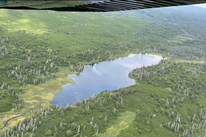
Location
Talachulitna West RRCS is approximately 19 miles southwest of Skwentna, 3.5 miles northwest of Hiline Lake, and 1.3 miles west of the Talachulitna River.
Access Details
Access to the area is by float or ski plane. The parcel is accessed directly from the unnamed lake.
Utilities
There is no municipal water supply or sewer system. Please see plat notes and the Sewer and Water section of this brochure for details. There are no utilities (electric, phone, internet, etc.) currently in this area.
Local Government
This area is within the boundaries of the Matanuska-Susitna Borough and is subject to applicable platting authority, local ordinances, and property assessments. Local ordinances may impose setbacks, easements, or restrictions in addition to those mentioned under restrictions. Please check with the Borough for more details.
Fire
This area is in the Modified Fire Management Option. See the Wildland Fires and Burn Permits section of this brochure for details.
Notes
These parcels may contain wetlands. Purchasers must obtain permits from the U.S. Army Corps of Engineers before developing any wetland areas.
Restrictions
Easements affecting these parcels, as depicted on the plat, may include, but are not limited to, public access easements. Information on restrictions, easements, reservations, and setbacks may be depicted on the plat, contained in the plat notes, or recorded separately. There is a 50ft public access easement and 100ft building setback from the ordinary high water mark of the lake. There is also a 30ft public access easement along all lot lines.
Survey and Appraisal
Talachulitna West RRCS is ASLS 2006-24, located in Section 5, Township 19 North, Range 12 West, Seward Meridian. The survey has been filed as Plat 2008-124 in the Anchorage Recording District.