
Old Sterling Highway North
Old Sterling Highway North
0 land parcels are currently available for sale.
Attention
A 100ft well radius from an adjacent property extends onto this property. This may affect the placement of a septic or wastewater disposal system on this parcel. Borough Code requires existing water source for private drinking water systems to be platted with approximate location and appropriate radius. Please contact the Kenai Peninsula Borough for more information.
Location
Old Sterling Highway North is located approximately 6 road miles southeast of Anchor Point and 10 miles northwest of Homer. The parcel is along the Old Sterling Hwy, approximately 2.6 miles north of the southern intersection of the Old Sterling Hwy and the New Sterling Hwy.
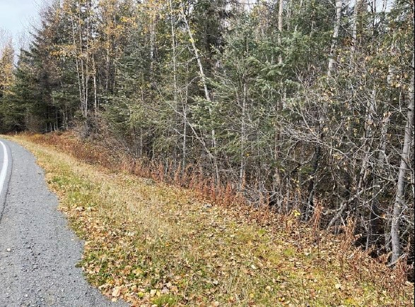
Access Details
Access is from the north side of the Old Sterling Hwy, approximately 2.6 miles north of the intersection of the Old Sterling Hwy and the New Sterling Hwy. The parcel does not have constructed driveway access. Driveway access will require a permit from DOT/PF.
Utilities
There is no municipal water supply or sewer system. Please see plat notes and the Sewer and Water section of this brochure for details. This area is currently served by Homer Electric Association. Electric and natural gas lines are located along the Old Sterling Hwy. Purchasers will be responsible for extending electric and natural gas lines to the parcel.
Local Government
This area is within the boundaries of the Kenai Peninsula Borough and is subject to applicable platting authority, local ordinances, and property assessments. Local ordinances may impose setbacks, easements, or restrictions in addition to those mentioned under Restrictions. Please check with the Borough for more details. There is currently no zoning for the subdivision.
Fire
The subdivision is in a Critical Fire Management Option. See the Wildland Fires and Burn Permits section of this brochure for details. The Division of Forestry notes that due to extensive spruce bark beetle kill, some areas of the Kenai Peninsula face extremely serious wildfire hazard potential.
Notes
A 100ft well radius from an adjacent property extends onto this property. This may affect the placement of a septic or wastewater disposal system on this parcel. Please see plat and contact the Alaska Department of Environmental Conservation for details. This parcel contains apparent wetlands. Purchasers must obtain permits from the U.S. Army Corps
of Engineers before developing any wetland areas.
Restrictions
Easements affecting this parcel, as depicted on the plat, may include, but are not limited to, utility easements. Information on restrictions, easements, reservations, and setbacks may be depicted on the plat, contained in the plat notes, or recorded separately. There is a 20ft utility easement and building setback along the lot line fronting the Old Sterling Hwy. There is a 100ft utility easement and a 50ft building setback across the northeast corner of the property. Please see plat for details.
Survey and Appraisal
Old Sterling Highway North is survey ASLS 2018-29, located in Section 24, Township 5 South, Range 15 West, Seward Meridian. The survey has been recorded as Plat 2020-31 in the Homer Recording District.
Right-of-way Status
Access to the parcel is from Old Sterling Hwy. The parcel does not have constructed driveway access.