Skip to content

Warning: JavaScript is disabled.
For full functionality and best experience on our site, it is necessary to enable JavaScript.
Here is instructions to enable JavaScript in your web browser

We use cookies to provide and improve our services. By using our site, you consent to cookies.
Alaska Department of Natural Resources
Division of Mining, Land and Water

Parcel Detail

Attention - Residency Requirements

Only Alaska residents may submit bids in the Sealed-Bid Auction.
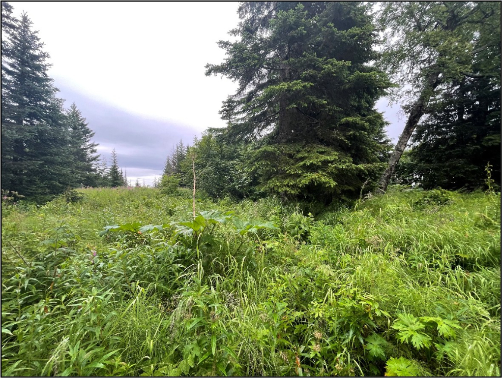
NINILCHIK BLUFF

Parcel 498 - 1022

Acres: 3.257 No Road Access Lot: 4
Minimum Bid:
$35,900.00

Case File

Veteran Discount

The State of Alaska offers qualified Alaska resident veterans a once-in-a-lifetime discount on the purchase of state land.

Estimated Veteran Price: $27,799.50

This veteran's price is based on the minimum bid. When placing your bid, you will be bidding a non-discounted price. The actual discounted price based on your bid will be calculated using the method detailed in the brochure, if you qualify for the program and win the parcel.

Location

Ninilchik Bluff is approximately 3.5 miles south of Ninilchik, 1.25 miles south of Deep Creek, and ½ mile east of the Sterling Hwy, at the end of Berrusa Rd.
Meridian Township Range Section (MTRS): S002S014W09

Access Details

From the Sterling Hwy, head east on Berussa Rd to the end. The parcels are located approximately 100 – 400 ft east of the end of the developed gravel surface.

Utilities

Electrical service is located just west of the subdivision but does not extend to the parcels. Prospective purchasers may need to extend lines at their own expense. Natural gas is not in the immediate area. There is no municipal water supply or sewer system. Please see plat notes and the Sewer and Water section of this brochure for details.

Local Government

This area is within the boundaries of the Kenai Peninsula Borough and is subject to applicable platting authority, local ordinances, and property assessments. Local ordinances may impose setbacks, easements, or restrictions in addition to those mentioned under Restrictions. Please check with the Borough for more details. There is currently no zoning for the subdivision.

Fire

This area is in the Critical Fire Management Option. See the Wildland Fires and Burn Permits section of this brochure for details.

Notes

These parcels may contain wetlands. Purchasers must obtain permits from the U.S. Army Corps of Engineers before developing any wetland areas.
In 2016 two eagle’s nests were identified on Parcel 1022. DNR field inspected the property in 2023 to see if the eagle’s nests were still active. One of the nests could not be located. The tree supporting the second nest had fallen over. This nest was inactive and no longer able to support nesting. During the field inspection an active nest was observed within the subdivision, on Lot 1 (private property). It is possible that the nest on Lot 1 is within 330ft of Parcel 1023 (Lot 3). Federal Law prohibits any disturbance of bald eagles or their nests. The US Fish and Wildlife service recommends no clearing of vegetation within 330ft of any nest, and no construction or disturbing activity within 660ft of any nest between June 1 and August 31. As with all parcels, DNR encourages prospective bidders to visit the properties and personally inspect them before placing a bid. Please see the Fish & Wildlife section of this brochure for more information.

Restrictions

Easements affecting these parcels, as depicted on the plat, may include, but are not limited to, utility easements. Information on restrictions, easements, reservations, and setbacks may be depicted on the plat, contained in the plat notes, or recorded separately. There is a 15ft utility easement and 20ft building setback along the Berussa Ct right-of-way. There is a 20ft (10ft on each parcel) public pedestrian easement along the lot line between Parcels 1022 & 1023. There is a 100ft building setback from wetlands. Please see plat for details.

Survey and Appraisal

Ninilchik Bluff Subdivision is survey ASLS 2016-01, located in Section 9, Township 2 South, Range 14 West, Seward Meridian. The survey has been recorded as Plat 2017-10 in the Homer Recording District.

Right-of-way Status

Berussa Road is a developed gravel road, however it ends before reaching the parcels. The final 400ft (shown on the plat as Berussa Ct) is undeveloped.
Back to Top