Reserve Pit Inventory Project
An inactive reserve pit on Gwydyr Bay South 1 pad, located on the North Slope. The associated pit has been backfilled above tundra grade (capped), to prevent ponding and to account for natural subsiding. Prior to capping the reserve pit was excavated until no waste remained.
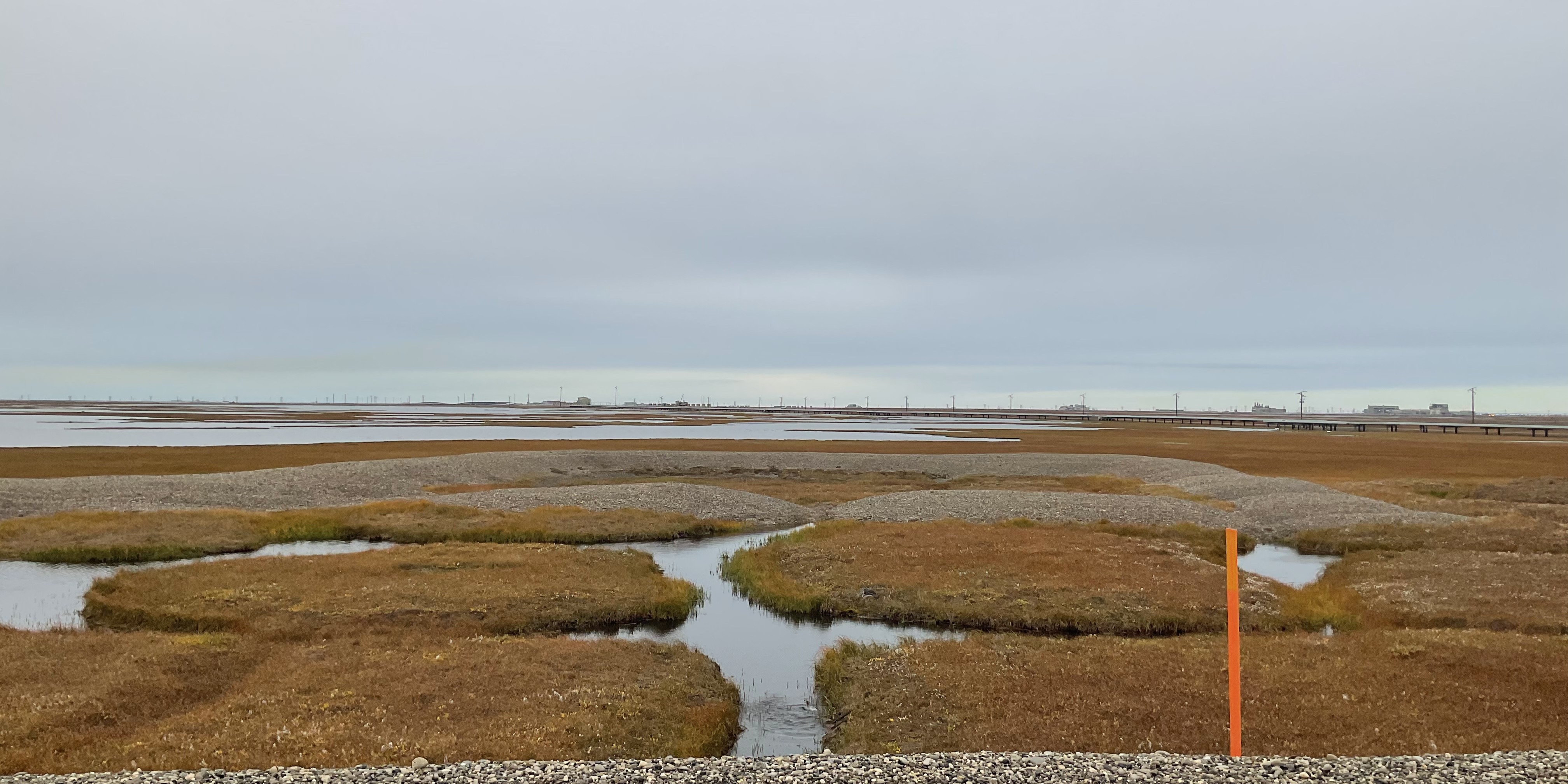
One of the three inactive reserve pits on D Pad, an active production pad on the North Slope. Reserve pits on active pads with waste in place will be excavated and closed following Alaska Department of Environmental Conservation (DEC) Solid Waste requirements at the end of pad life.
An inactive reserve pit for Drill Site 3N on the North Slope. This pit is considered closed, drilling waste has been removed. Backfilling has been postponed until the end of pad life, to reduce risk to infrastructure posed by backfilling.
An inactive reserve pit for Drill Site 2Z on the North Slope. This pit is considered closed, drilling waste has been removed. Backfilling has been postponed until the end of pad life, to reduce risk to infrastructure posed by backfilling.
An inactive reserve pit for West Beach State on the North Slope. This pit is considered closed, drilling waste has been removed. The associated pits have been backfilled to tundra grade.
What are Reserve Pits?
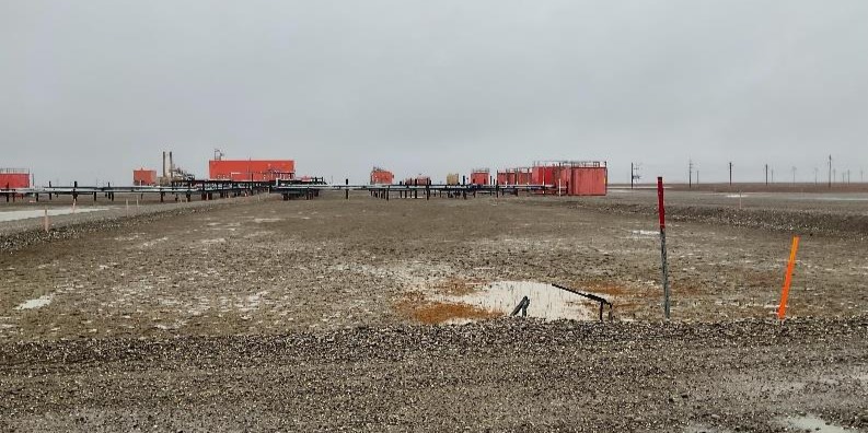
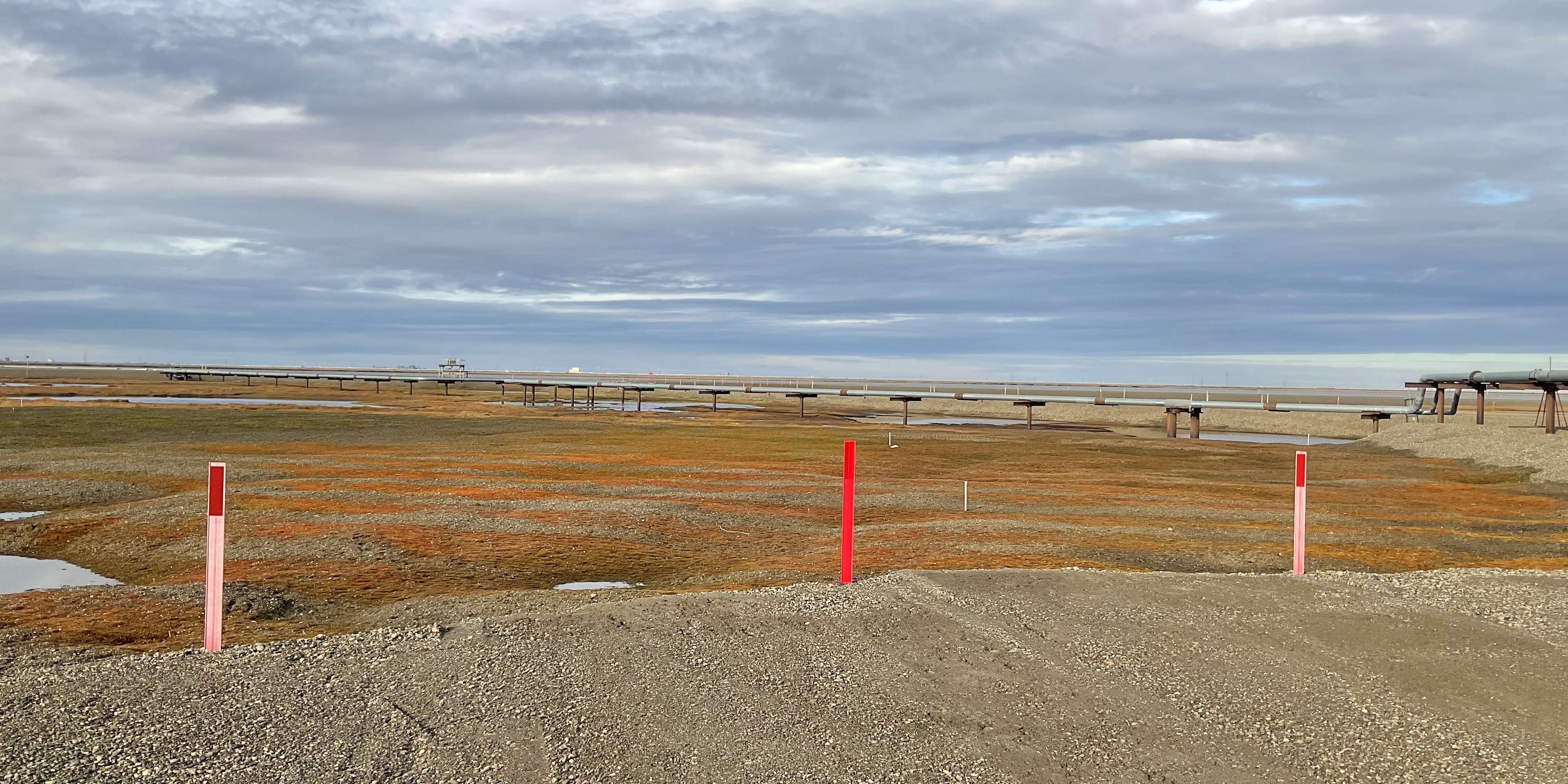
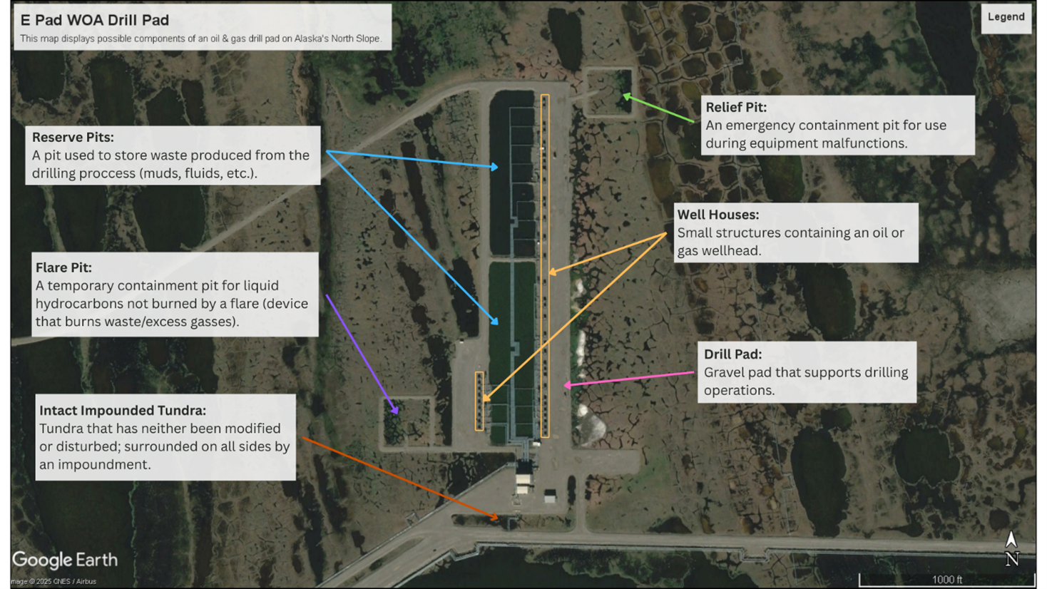
Reserve pits are either above (bermed) or below ground containment pits used to store drilling muds and waste created during the process of drilling oil and gas wells prior to 1996. The drilling waste present in these pits can contain diesel and other petroleum-based products, as well as heavy metals and salts. Water pooling and erosion of reserve pits can allow these contaminants to spread into the surrounding environment, altering soil salinity and alkalinity levels, in addition to providing a path of exposure to both people and wildlife. Currently there are approximately 360 known reserve pits on DNR managed land.
In 1987, Alaska Department of Environmental Conservation (ADEC) regulations changed to no longer authorize new reserve pits and require all non-active reserve pits to be closed or removed. The development of underground injection control (UIC) wells has replaced reserve pits as the preferred method for drilling waste disposal in Alaska.
Reserve Pit Inventory Project
Over the past several years SAIL has digitized Alaska Department of Environmental Conservation reserve pit files for reserve pits on DNR managed lands. The purpose of this inventory work is to capture reserve pit information in DNR's Land Administration System, documenting the presence of reserve pits on DNR managed lands to aid in responsible management of these lands. The database document's location, presence of waste, closure status, and any other relevant information.
 View the Interactive Map
GIS
(April 2026)
View the Interactive Map
GIS
(April 2026)
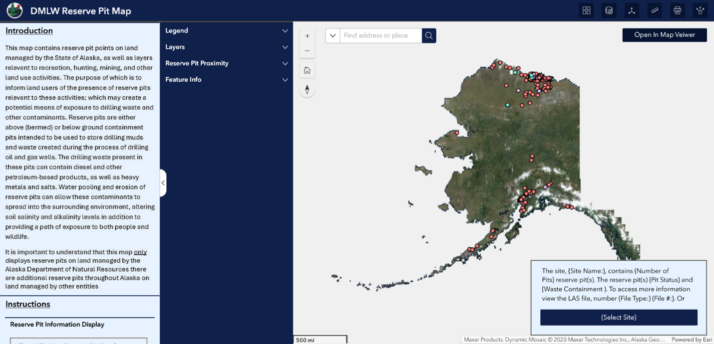
The inventory information has been developed into the DMLW Reserve Pit Map, a publicly accessible information source for reserve pits located on DNR managed land within Alaska. It does not include over 300 reserve pits located on land within Alaska not managed by DNR (including state owned lands, such as Mental Health Trust lands and University of Alaska lands).
Erosion Analysis
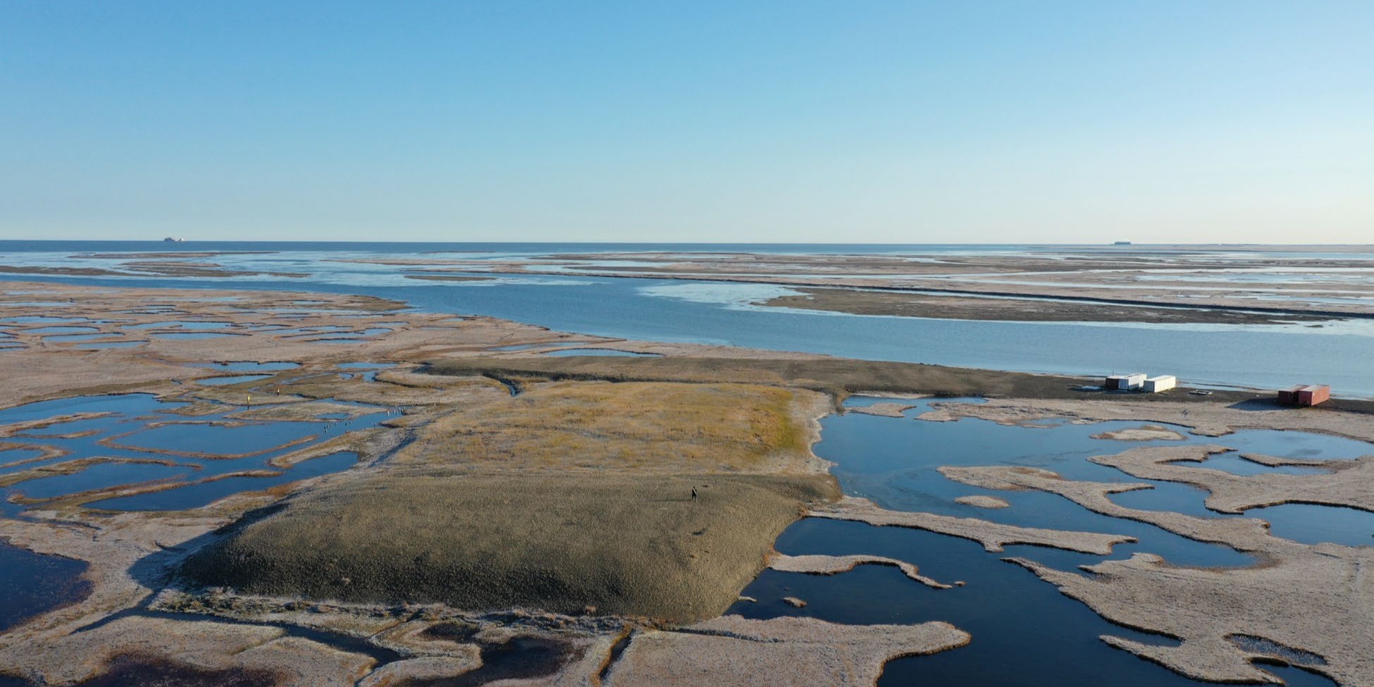
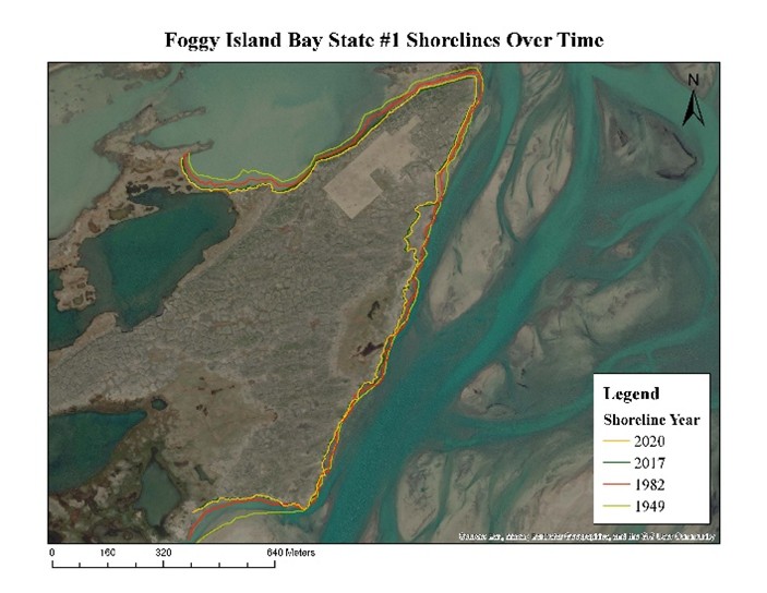
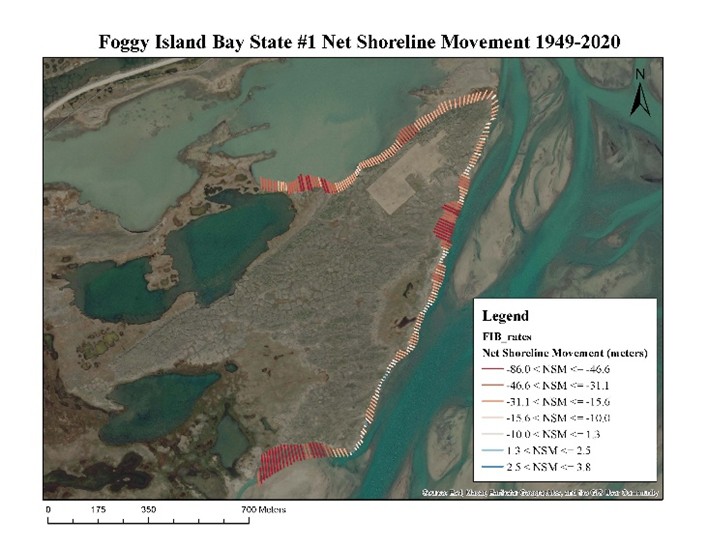
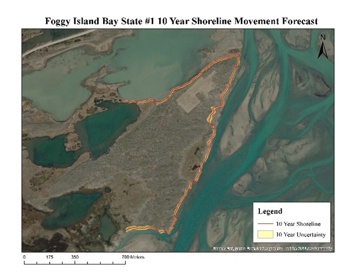
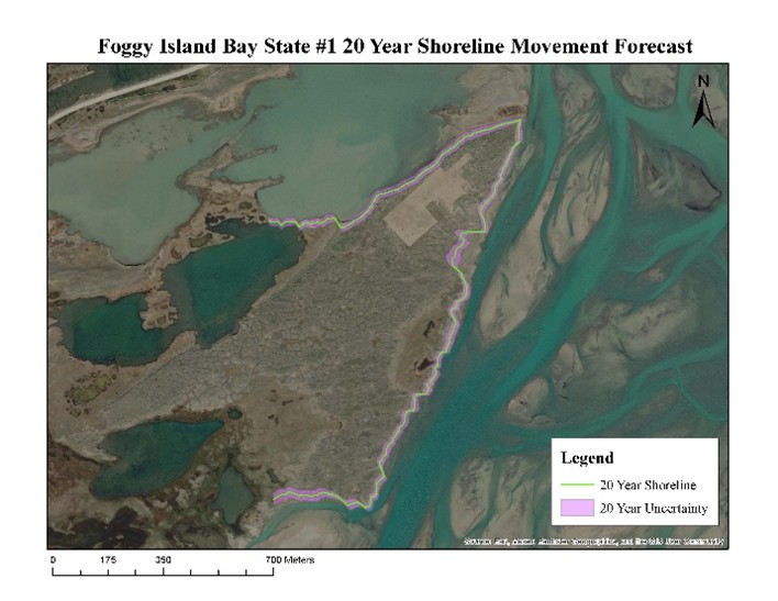
A past SAIL internship project involved conducting preliminary erosion assessments to address the management concern of shoreline erosion. This is most prevalent on the North Slope of Alaska due to permafrost, however sites across Alaska can be susceptible to degradation from erosion. Our erosion analysis work involves mapping shorelines over time using historical aerial imagery and running this data through United States Geological Survey (USGS) Digital Shoreline Analysis software (DSAS) to identify at risk sites.
Erosion Analysis Example
These diagrams show the results of erosion analysis performed on Foggy Island Bay State #1; corrective actions have now been taken to remediate the reserve pit under 18 AAC 60 and the Solid Waste Program and other areas of contamination on the pad.
Additional Resources
EPA: General Information About Injection wells External ADEC Tundra Treatment Guidelines DEC Regulations, 18 AAC 60, Solid Waste Management