
Public Access Assertion and Defense
ANCSA 17(b) Easements
What Are They?
The "17(b) Easements" are named after the section of the Federal Regulation, Alaska Native Claims Settlement Act "ANCSA" (PL 92-203 - 85 Stat. 688). This Federal Regulation allows reserving easements on lands which will be conveyed to Alaska Native Village and Regional Corporations in order to allow public access to public land and water. The Federal Regulations, 43 CFR 2650.4-7, describe the guidelines which are used in reserving easements in conveyance documents.
Quick Links
How Can Easements Be Used?
There are different widths of 17(b) trail easements and site easements which allow certain uses. Please note: Departing from these easements on to Native lands without express permission from the Native Land owners is trespass. Please research land status before using these easements and respect the private property rights of the land owners. Below is a list of how you can use each type of easement.
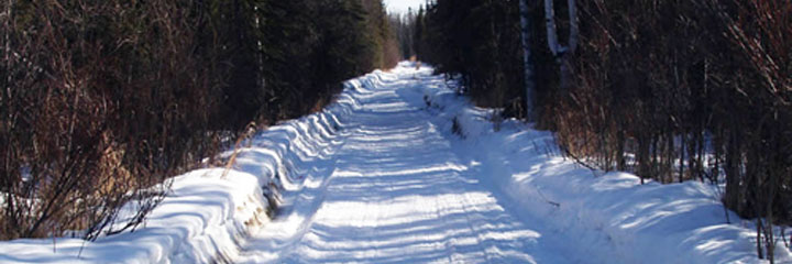
25-Foot Trail - The uses allowed on a 25-foot-wide trail easement are: travel by foot, dogsleds, animals, snowmobiles, two- and three-wheeled vehicles, and small all-terrain vehicles (less than 3,000 lbs. gross vehicle weight).
50-Foot Trail - The uses allowed on a 50-foot-wide trail easement are those allowed for a 25-foot trail plus large all-terrain vehicles (more than 3,000 lbs. gross vehicle weight), tracked vehicles, and four-wheel-drive vehicles.
60-Foot Road - The uses allowed on a 60-foot-wide road easement are those allowed for 25- and 50-foot trails plus automobiles and trucks.
1-Acre Site - The uses allowed on a site easement are: vehicle parking (e.g., aircraft, boats, all-terrain vehicles, snowmobiles, cars, and trucks), temporary camping, and loading or unloading. Temporary camping, loading, or unloading is limited to 24 hours.
Where Are They Located?
If you know the location of the area you are interested in you can look on the BLM for 17(b) easement map quads by the United States Geological Survey (USGS) name on the BLM Easements System website. A Legend is available to assist you in interpreting the easement maps.
If you do not know the United States Geological Survey quad name and number you can search for the map by using a legal description (meridian, township and range) from the DNR Land Records Information System by finding the Master Title Plat listed under Federal Records. For help in interpreting plats, contact a Department of Natural Resources (DNR) or Bureau of Land Management (BLM) Public Information Office, or use the on-line help functions.
Who Manages 17b Easements?
17(b) easements are reserved and managed by the federal government. If you have a question on the management of a 17(b) easement please contact the BLM Field Offices in Anchorage, Glennallen or Fairbanks.
The State's Role in ANCSA Conveyances
The State of Alaska, Department of Natural Resources, Division of Mining, Land, and Water, Public Access Assertion and Defense (PAAD) Unit includes an Easement and Navigability Sub-Unit. The PAAD Unit's Easement Sub-Unit focuses on the protection of access across land to public lands and waters. We also coordinate with other state agencies as needed.
Native Allotment Review: The PAAD Easement Sub-Unit reviews and sends comments to the DNR Realty Services Office concerning Native Allotments which are reviewed for existing trails or sites easements which may cross or predate a Native Allotment use and occupancy. Realty Services then sends the comments to BLM for consideration before the Certificate of Native Allotment is issued.
Native Corporation Land Conveyance Review: On December 10, 2004 the BLM 2009 Alaska Land Transfer Acceleration Act was passed. BLM's goal is to complete all their final conveyances by 2009.
17(b) easements are reserved to provide access to public lands, public resources and groups of private inholdings sufficient in number to constitute a public use. Many easements are not marked and most are not surveyed. The right to use the easement is usually limited to transportation purposes. These easements are intended to provide access across private Native lands, and along public waterways. The state does not manage 17(b) easements or Native lands but may encourage a donation of site easements to facilitate safe modes of transportations, change in mode of transportation locations, and rest areas along waters used as transportation routes. Long term camping is prohibited on site easements.
DNR reviews the conveyance actions of BLM to protect State interests. BLM sends out a public notice when a section of land will be conveyed to a Native Corporation. The PAAD Unit reviews the conveyance document to see if easements should remain (if existing), be reserved, continued, or terminated. The PAAD Unit sends their comments to BLM who collects the recommendations from State and Federal agencies and interested parties prior to issuing the final conveyance documents. Public easements and facilities may be dedicated by Native Corporations following the conveyance of the lands. Search the Land Records Information site by community name for existing 14(c) surveys. Search the Community Profile maps for aerials with planned easements.

Additional Information
To obtain additional information, please provide the name of the USGS quad map and the, Section, Township, Range, and Meridian for the location. Also look at the federal Master Title Plat and look for the "IC" or Interim Conveyance number or the federal patent number that starts with "50-..-....".
For information about accessing Native Corporation land outside of an easement boundary contact the Regional Corporation.
Map of Alaska Regional Corporation boundaries
DNR updates the easement data several times a year. The most current information can be found at the Federal Bureau of Land Management (BLM).
The Department of Natural Resources has Public Information Offices in Anchorage, Fairbanks and Juneau. BLM Field Offices in Anchorage, Fairbanks or Glennallen can help interpret the 17(b) maps and easement management policies.
For more information on the status of Federal conveyances see the BLM Alaska 17(b) web page.