
Navigability Program
State Policy on Navigability
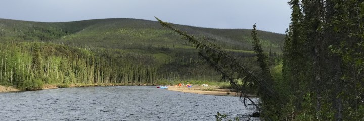
Table of Contents
- I. Identifying and Protecting State Title to the Beds of Navigability
- Riparian Rights and Statute of Limitations
- Navigability Criteria
- Navigability Criteria Disputes
- Identification of Navigable Waters
- Navigable Waters within Pre-Statehood Federal Withdrawals
- Navigable Waters within ANILCA Conservation System Units
- II. Legal and Policy Guidelines Governing Management of Submerged Lands and Public Waters
Policies and Procedures on Ownership and Management of Navigable and Public Waters
June 18,1996 State ownership of the beds of navigable waters is an inherent attribute of state sovereignty protected by the United States Constitution. Utah v. United States, 482 U.S. 193 (1987). Under the doctrine, all states enter the Union on an equal footing with respect to sovereign rights and powers, title to the beds of navigable waters in Alaska vested in the newly formed State of Alaska in 1959. In addition, under the Alaska Constitution and the public trust doctrine, all waters in the state are held and managed by the state in trust for the use of the people, regardless of navigability and
The purpose of this paper is to describe the State of Alaska's policies and procedures for identifying and protecting the state's title to the beds of navigable waters. In addition, this paper outlines the legal and policy considerations which guide the ownership and management of submerged lands and public waters.
I. Identifying And Protecting State Title To The Beds Of Navigable Waters
Identification and management of the beds of navigable waters is an important policy of the State of Alaska. In 1980, the state established a comprehensive navigability program to respond to federal land conveyances and land management activities under the Alaska Statehood act, the Alaska Native Claims Settlement Act (ANCSA), and the Alaska National Interest Lands Conservation Act (ANILCA). Pursuant to the provisions of those acts, the federal government has issued navigability determinations for thousands of lakes, rivers, and streams throughout the state in an effort to determine whether the state or federal government owns the submerged lands. Navigability determinations are also made prior to many state land disposals to insure that
The basic purpose of the state's program is to protect the public rights associated with navigable waters, including, in particular, the state's title to the submerged lands. Because state and native land selections and federal conservation units blanket the state, navigability questions have arisen for rivers, lakes, and streams throughout Alaska. The navigability of many of those waterbodies has a lready been established. There are hundreds of others, however, where navigability is not yet determined.
To help resolve these navigability disputes, a major goal of the state's navigability program is to identify the proper criteria for determining title navigability in Alaska and to gather sufficient information about the uses and physical characteristics of individual waterbodies so that accurate navigability determinations can be made as disputes arise. Other important aspects of the program include monitoring federal land conveyance and management programs to identify particular navigability disputes, seeking cooperative resolution of navigability problems through negotiations and legislation, and preparing for statewide navigability litigation.
Riparian Rights And Statute Of Limitations
Disputes over ownership of submerged lands in Alaska have arisen under a variety of circumstances. The principal source of the disputes in Alaska is the survey and acreage accounting system used by the federal government for conveying land to the state and native corporations.
The standard procedures for surveying and conveying federal land are found in the Manual of Instructions for the Survey of the Public Lands of the United States, generally known as the BLM Manual of Surveying Instructions. Under those procedures, consistently used in every public land state except Alaska, only uplands are surveyed and conveyed in fulfillment of acreage entitlements, not submerged lands. The survey rules require that all lakes 50 acres or larger, and rivers and streams three chains (198 feet) in width or wider, regardless of navigability, be meandered and segregated (excluded) from the surveyed public lands. Only the surveyed uplands are conveyed. The acreage of meandered rivers, lakes, and streams is not included in computing the amount of land involved in the conveyance.
In Alaska, however, the federal government had not consistently followed these survey rules. Until 1983, the federal government treated submerged lands the same as uplands. All bodies of water that were considered non-navigable by the federal government, regardless of size, were surveyed as though they were uplands and the acreage of submerged lands was charged against the total acreage entitlement.
Because of these conveyance procedures, the navigability of waterbodies in Alaska has been an issue of contention since the enactment of the Alaska Statehood Act and ANCSA. In addition to the problems caused by a lack of information about many waterbodies, the situation was exacerbated by the narrow definition of navigability used by the federal government. Hundreds of rivers, lakes, and streams considered navigable by the state were determined non-navigable by the federal government.
In 1983, following years of negotiations, lawsuits and legislative attempts to solve the navigability problems created by the unusual survey and conveyance procedures in Alaska, the State of Alaska, the United States Department of the Interior and the Alaska Federation of Natives (AFN) agreed that the standard rules of survey should be followed for land conveyances in Alaska. The effect of that decision was to treat Alaska surveys and land conveyances like federal land surveys and conveyances in other states. The recipients of conveyances from the federal government are charged only for the amount of public land that is calculated by the survey, which does not include the areas of meandered rivers, lakes and streams.
The use of these survey procedures has eliminated many of the problems associated with the federal land conveyance programs in Alaska. Submerged lands are no longer being conveyed to fulfill acreage entitlements. With the exception of lakes smaller than 50 acres and streams narrower than 198 feet, navigability determinations are no longer being made prior to federal land conveyances. Determinations of ownership of submerged lands can be put off until a natural resource use or conflict requires resolution, such as issuance of an oil and gas lease, mining claim, or a gravel sale.
Through the joint efforts of the State of Alaska, AFN, and the Department of the Interior, the 1983 decision to use the standard survey procedures for land conveyances in Alaska was legislatively approved in August 1988 when the United States Congress passed legislation (94 Stat. 2430) amending Section 901 of the Alaska National Interest Lands Conservation Act, codified at 43 U.S.C. 1631. The 1988 amendment, sometimes referred to as the Alaska Submerged Lands Act, requires that the standard rules of survey in the BLM Manual of Surveying Instructions be used for all federal surveys under the Alaska Statehood Act and ANCSA. The 1988 amendment also repealed the Section 901 statute of limitations that would have required the state to file a lawsuit within a very short period of time in order to preserve its title to the beds of navigable waters conveyed to native corporations by the federal government as a result of erroneous navigability determinations, poor maps, surveys or whatever. Even with this legislation, a major problem concerning navigability decisions made by the federal government under the old system remains unresolved. At issue are the hundreds of erroneous non-navigability decisions and the resulting submerged land conveyances made to ANCSA corporations in previous years. In addition, to comply with the meandering requirements of the BLM Survey Manual, the federal government is still required to make navigability determinations for lakes smaller than 50 acres and rivers or streams narrower than 198 feet in width to determine if these waters must be meandered.
Navigability Criteria
The greatest hurdle to overcome in the state's efforts to identify and manage navigable waters has been the long- standing differences of opinion between the State of Alaska and the United States regarding the application of the test for determining title navigability. Navigability is a question of fact, not a simple legal formula. Variations in waterbody use that result from different physical characteristics and transportation methods and needs must be taken into account. There are many legal precedents for determining navigability in other states based upon the particular facts presented in those cases. In Alaska, though, we are just beginning to get the final court decisions that are necessary to provide legal guidance for accurate navigability determinations.
The physical characteristics and uses of a waterbody used by the state for asserting navigability, commonly referred to as navigability "criteria", are based upon legal principles that have been established by the federal courts. These criteria are applied to rivers, lakes, and streams throughout the state and take into account Alaska's geography, economy, customary modes of water-based transportation, and the particular physical characteristics of the waterbody under consideration.
The federal test for determining navigability was established over a hundred years ago. In the landmark decision of The Daniel Ball, 77 U.S. (19 Wall.) 557, 563, (1870), the Supreme Court declared:
Those rivers must be regarded as public navigable rivers in law which are navigable in fact. And they are navigable in fact when they are used, or are susceptible of being used, in their ordinary condition, as highways of commerce, over which trade and travel are or may be conducted in the customary modes of trade and travel on water.
Although The Daniel Ball test is accepted as the correct standard for determining navigability, there has been a lot of disagreement over application of many of the terms and phrases used in The Daniel Ball test to the specific uses of Alaska's lakes, rivers and streams. The State of Alaska uses the following interpretation of that test as the basis for its navigability program.
The Waterbody Must Be Usable As a Highway For the Transportation of People or Goods. Interpreting the requirements that navigable waterbodies be used or usable as "highways of commerce", the courts have ruled that the central theme of title navigability is that the waterbody be capable of use as a highway which people can use for transporting goods or for travel. Neither the types of goods being transported nor the purpose of the travel are important in determining navigability. Transportation on water associated with recognized commercial activities in Alaska, such as mining, timber harvesting, and trapping is, evidence of navigability. The use of waterbodies for transportation in connection with natural resources exploration or development, government land management, management of fish and game resources, or scientific research is also evidence of navigability. Travel by local residents or visitors for the purpose of hunting, fishing, and trapping, or as a means of access to an area can be used to establish navigability. The same holds for recreational transportation, including personal travel and professionally guided trips.
Waters Which Are Capable of Being Used For Transporting Persons and Goods, Although Not Actually Used, Are Navigable. It is not necessary that a waterbody be actually used for transportation to be found navigable. It is enough that it is susceptible, or physically capable, of being used. Whether a waterbody is susceptible of use for transportation depends upon the physical characteristics of the water course such as length, width, depth, and, for a river, current and gradient. If those physical characteristics demonstrate that a waterbody could be used for the transportation of persons or goods, it is legally navigable.
The susceptibility element of title navigability is very important for the identification of navigable waterbodies in Alaska. Because of Alaska's sparse population and lack of development, there are hundreds of remote rivers, lakes, and streams where there is little or no evidence of actual use. Because of their physical characteristics, however, many of these remote waterbodies could be used for transporting people or goods if there was a need. Under these circumstances, they are considered legally navigable.
Transportation Must Be Conducted In the Customary Modes of Trade and Travel On Water. A finding of navigability does not require use or capability of use by any particular mode of transportation, only that the mode be customary. The courts have held that customary modes of transportation on water include all recognized types and methods of water carriage. Unusual or freak contrivances adapted for use only on a particular stream are excluded. Customary modes of trade and travel on water in Alaska include, but are not limited to, barges, scows, tunnel boats, flat-bottom boats, poling boats, river boats, boats propelled by jet units, inflatable boats, and canoes. In places suitable for harvesting timber, the flotation of logs is considered a customary mode of transportation.
The mode of travel must also be primarily waterborne. Boats which may be taken for short, overland portages qualify. The courts have ruled that the use of a lake for takeoffs and landings by floatplanes is insufficient, in and of itself, to establish navigability.
Without expressly rejecting the claim, at least two court decisions in Alaska have suggested that winter travel on the surface of a frozen river or lake is probably not evidence of navigability. The rivers involved in the two adjudicated cases were both found navigable based upon summer use by boats, however, and it appears likely that most waterbodies in Alaska that are used as highways in winter can also be travelled by at least small boats in the summer. Because of this, the state need not rely upon winter travel to support navigability.
Waters Must Be Navigable In Their Natural and Ordinary Condition. A waterbody which can be used for transportation only because of substantial man-made improvements to the condition of the watercourse is not navigable for title purposes. However, if transportation does or could occur on the waterbody even without the improvements and the improvements would only make transportation easier or faster or possible for larger boats (e.g., dredging), it is still considered navigable for title purposes.
The presence of physical obstructions to navigation (rapids, falls, log-jams, etc.) does not render a waterway non- navigable if the obstruction can be navigated despite the difficulties or if the obstruction can be avoided by other means, such as portaging, lining, or poling. A waterbody is also navigable even if seasonal fluctuations do not allow it to be navigated at all times of the year. However, a waterbody which is only navigable at infrequent and unpredictable periods of high water is not normally considered navigable. The fact that a waterbody may be frozen for several months of the year does not render it non-navigable if it is navigable in its unfrozen condition.
Title Navigability Is Determined As Of The Date Of Statehood. To be considered navigable for title purposes, the waterbody must have been navigable in 1959 (when Alaska became a state). This element of the navigability test focuses on the physical characteristics of the waterbody and whether those characteristics have changed significantly since statehood. Most waterbodies have not physically changed enough since statehood to alter their navigability. Assuming there have been no significant changes in the physical characteristics of the waterbody, a waterbody that is navigable today would be considered legally navigable in 1959 as well. Exceptions might include the creation, by natural or man-made causes after statehood, of a totally new lake, river, or canal now used for navigation. Such a waterbody would not be considered navigable for title purposes. Conversely, a waterbody which was navigable in 1959 but, because of natural or man-made physical changes, is no longer navigable in fact would still be considered navigable for title purposes.
Navigability Criteria Disputes
Because of differing legal interpretations of court navigability decisions, several aspects of the criteria used by the state to determine navigability have been disputed by the federal government. As a direct result of these criteria disputes, many waterbodies considered navigable by the state have been determined non-navigable by the federal government.
The major criteria dispute has been over the type or purpose of the transportation required to establish navigability. The federal government has asserted that a waterway must be used, or capable of use, for transporting commerce to be considered navigable. Other, "noncommercial" transportation uses are not considered sufficient to establish navigability. In this context, the federal government has claimed that the only relevant "commercial" transportation is the distribution of goods for sale or barter, or the transportation for hire of people or things. The federal government has admitted that professionally guided transportation on Alaska's rivers, lakes and streams constitutes commerce, but nevertheless has argued that the waters are not being used as a navigable "highway" when recreation is involved, but rather more as an amusement park. The federal government has therefore claimed that waters used only for commercial recreation are legally nonnavigable even though they may be navigable in fact.
Through the work of the state's navigability program, this definition has been repeatedly rejected by the courts, most recently in the Gulkana River case. Alaska v. United States, 662 F.Supp.455 (D.Alaska 1987), affirmed sub nom. Alaska v. Ahtna, Inc., 891 F.2d 1401 (9th Cir. 1989). Applying the correct definition of navigability, many of the submerged lands that the federal government attempted to convey to ANCSA corporations should have been recognized as belonging to the state. The state appealed many conveyances to protect its title. As occurred in the Kandik-Nation Rivers appeal, Appeal of Doyon, 86 I.D. 692 (ANCAB 1979), Alaska Native Corporations also found it necessary to challenge erroneous federal determinations of non-navigability to insure they would not be deprived of any portion of their entitlement by being charged for submerged land owned by the state.
The federal government has also argued that aluminum boats, boats propelled by jet units, inflatable boats, and canoes are not customary modes of travel for the purpose of determining navigability in Alaska. As a result, many waterbodies navigated by these types of watercraft have been found legally non-navigable by the federal government. The claim is that these boats represent post-statehood technological advances, are too small to be considered "commercial", or that most "commercial" use of the watercraft developed after statehood.
Another navigability dispute involves remote, isolated lakes. The federal government has found many of these lakes legally non-navigable, even though they are physically capable of being navigated. The federal government's contention is that a navigable connection to another area is necessary to make travel on a remote lake worthwhile. Otherwise, the federal government views the lack of development in the area around the isolated lake as an indication that the lake will never be used for commercial transportation.
To resolve these navigability criteria disputes, the state has actively pursued a limited number of court cases challenging particular findings of non-navigability by the federal government. With the sole exception of floatplanes, the courts have agreed with the navigability criteria presented by the State of Alaska and have rejected the limitations suggested by the federal government. These cases include:
Gulkana River. In this case, both in the U.S. District Court and on appeal to the U.S. Court of Appeals, the federal courts rejected the federal government's restrictive interpretation of the phrase " highway of commerce" in the title navigability test. The federal district court stated that to demonstrate navigability, it is only necessary to show that the waterbody is physically capable of "the most basic form of commercial use: the transportation of people or goods." Because the Gulkana River can be used for the transportation of people or goods, the Gulkana River was found navigable. Alaska v. United States, 662 F.Supp.455 (D.Alaska 1987). On appeal, the court of appeals affirmed the district court's finding of navigability. Alaska v. Ahtna, Inc., 892 F.2d 1401 (9th Cir. 1989). The court of appeals found that the modern use of the Gulkana River for guided hunting, fishing, and sightseeing trips is a commercial use and, since the physical characteristics of the river have not significantly changed since 1959, provides conclusive evidence that the river was susceptible of commercial use at statehood. The court also found that modern inflatable rafts can be used to establish navigability. In April 1990, the United States Supreme court denied a request by Ahtna, Inc. to reconsider and overturn the court of appeals decision. The Gulkana River precedent is now binding on all future navigability determinations in Alaska.
Kandik and Nation Rivers. In this administrative appeal, the State of Alaska and Doyon Limited, an ANCSA regional corporation, successfully established that the use or susceptibility of use of a river or stream by an 18-24 foot wooden riverboat capable of carrying at least 1,000 pounds of gear or supplies is sufficient to establish navigability. Based upon the use of these types of boats for the transportation of goods and supplies by fur trappers, as well as extensive historic and contemporary canoe use, the court found the Kandik and Nation rivers, in Interior Alaska, navigable. Appeal of Doyon, 86 I.D.692 (ANCAB 1979).
Alagnak River. In this federal district court case, the Alagnak River, the Nonvianuk River, Kukaklek Lake and Nonvianuk Lake were all found navigable. These interconnected waterbodies are located in the Bristol Bay region of Alaska, south of Lake Iliamna. Their primary transportation use is for commercially guided hunting, fishing, and sightseeing and for government research and management. They also serve as a means of access for local residents to their homes and to the surrounding areas for subsistence hunting and fishing. After several years of litigation, the federal government conceded that these rivers and lakes are navigable. Alaska v. United States, No. 82-201 (D.Alaska Feb. 2, 1985).
Matanuska River. The recommended decision in this administrative appeal agreed with the State of Alaska's position that post-statehood commercial river rafting operations are sufficient to establish navigability. Based upon that type of use, the administrative law judge who heard the case recommended that the Matanuska River, in Southcentral Alaska, be found navigable. The Secretary of Interior, over the state's objections, assumed jurisdiction over the case and stayed implementation of the recommended decision. No action has been taken in the case since that time. Appeal of Alaska, No. 82-1133 (IBLA Rec. Decision Aug. 18, 1983)
Slopbucket Lake. The state claimed that the extensive use of floatplanes on Slopbucket Lake, a twenty acre lake adjacent to Lake Iliamna, was sufficient to establish navigability. The federal courts rejected this view. The courts reasoned that floatplanes do not use the lake as a navigable highway; they just take off and land there. Alaska v. United States, 754 F.2d 851 (9th Cir.) cert denied, 106 S. Ct. 333 (1985).
Identification Of Navigable Waters
Even if the criteria for determining navigability in Alaska were totally agreed upon, it still would be difficult to prepare a complete list of all of the navigable lakes, rivers, and streams in the state. Much of Alaska has not yet been surveyed and many maps are inaccurate and out-of-date. It is an immense and complex task simply to identify and locate all of the thousands of named and unnamed lakes, rivers, and streams in the state which might be considered navigable. Furthermore, once a potentially navigable lake, river, or stream has been identified, detailed information about its size and uses is necessary for an accurate navigability determination. Because of Alaska's undeveloped and remote character, gathering navigability information is both time consuming and expensive. Finally, administrative navigability determinations made by the state or the federal government are always subject to legal challenge, since only the courts can authoritatively determine title to submerged lands.
Despite these difficulties, both the state and the federal government are frequently called upon to issue navigability determinations. Although the requirement that BLM adhere to the meandering requirements of the BLM Survey Manual has eliminated the need for navigability determinations on the larger rivers, lakes, and streams, which must now be meandered regardless of navigability, navigability determinations are still required for the smaller rivers, lakes, and streams to determine if they are to be meandered at the time of survey. Because of this, some navigability determinations are still made for nearly every federal land conveyance under ANCSA or the Alaska Statehood Act. The management plan for nearly every federal Conservation System Unit (CSU) also addresses the navigability issue.
Federal navigability determinations are reviewed by the state to insure that available information sources were used and interpreted correctly. Where the federal government determines non-navigable a waterbody which is considered navigable by the state, the state may provide the government with supplemental information about the uses and characteristics of the waterbody to obtain a redetermination of navigability. Under some circumstances the state needs to make its own navigability determinations, such as for a oil and gas lease sale, land disposal, material sale, mining claim, or another use of state land or resources requiring a determination of ownership of submerged lands within the affected area.
For large, undeveloped regions of Alaska there may be little or no accurate waterbody use or physical characteristics information available for making navigability determinations. When information is lacking, and it must make a navigability determination, the state is forced to rely solely upon the physical characteristics shown on maps and aerial photographs. In these cases, the state identifies as navigable all streams depicted on the U.S.G.S. maps with double lines (generally at least 70 feet wide) and having an average gradient over the length of the stream of no more than 50 feet per mile. With rare exceptions, the state's experience has been that streams of this type are deep enough and wide enough to be navigable by boats carrying persons or goods and must, therefore, be considered legally navigable. Streams depicted with single lines, although narrower in width, may also be listed as potentially navigable if they have gradients of substantially less than 50 feet per mile.
If there is no public use or physical characteristics information readily available for lakes, those lakes which are shown on maps and aerial photographs as having a navigable water connection with other navigable waters, or which are accessible by short overland portages, are considered navigable regardless of the size of the lake. These lakes are part of a system of interconnected navigable waters. If a lake is totally isolated, it will be included on the state's navigability maps if it is at least 1 1/2 miles long. That length insures that the lake can be used as a "highway". Future judicial decisions interpreting the "highway" requirement for isolated lakes could shorten or lengthen this 1 1/2 mile "rule of thumb."
The state recognizes that, under some circumstances, lakes smaller than 1 1/2 miles long can be and are used as navigable highways. In those cases, when known, these smaller lakes are also depicted on the state's navigability map. Moreover, as a matter of administrative policy and convenience only, the state may sometimes make an exception to the 1 1/2 mile standard in the extremely wet regions of the state, including some areas in the Yukon- Kuskokwim Delta, Yukon Flats, and on the North Slope. In these areas, an isolated lake might need to be 2-3 miles long to be included on the state's navigability maps. Although smaller lakes in these areas are capable of being used for transportation and should be found navigable by the courts, the state has decided to concentrate its limited resources in protecting the larger waterbodies first.
Navigable Waters Within Pre-Statehood Federal Withdrawals
Although disputes over which waters in Alaska are navigable are the most frequent cause of submerged land ownership disputes, there is another major legal issue which poses a threat to Alaska's sovereign claim to the beds of navigable waters. Even where navigability is conceded, the federal government often contends that title to the submerged lands did not vest in the state if the area was withdrawn or reserved by the federal government on the date of statehood. Within native conveyance areas, the federal government has used this claim of "reserved submerged lands" to justify its attempts to convey the beds of navigable waters in fulfillment of the native entitlements. Within state selections, the federal government has used the same claim to charge the acreage of submerged lands against the state's entitlement.
The state strongly disagrees with this federal claim and has actively pursued a number of court challenges to resolve the issue. In addition to numerous appeals from federal decisions to convey or charge for the beds of navigable waters, the state was actively involved as a friend of the court in one case before the United States Supreme Court and continues to be involved in another Supreme Court case which presents this issue. The pending case is United States v. Alaska, U.S. Supreme Court 84 Original (filed June, 1979).
On June 8, 1987 the Court issued its decision in Utah v. United States, No. 85-1772 (filed Oct. 14, 1986). In this case the federal government, in 1976, issued oil and gas leases for land underlying Utah Lake, a navigable waterbody located in Utah. The suit sought a declaratory judgement that Utah, rather than the United States, holds the lands under navigable waters in the territories in trust for future states, and, absent a prior conveyance by the federal government to third parties, a state acquires title to such land upon entering the Union on an "equal footing" with the original 13 states.
The Supreme Court held that title did pass to the state upon Utah's admission to the Union. They held that there is a strong presumption against finding congressional intent to defeat a state's title, and, that in light of the longstanding policy of the federal government's holding land under navigable waters for the ultimate benefit of future state absent exceptional circumstances, an intent to defeat a state's equal footing entitlement could not be inferred from the mere act of the reservation itself. The United States would not merely be required to establish that Congress clearly intended to include land under navigable waters within the federal reservation, but would additionally have to establish that Congress affirmatively intended to defeat the future state's title to such land.
This decision has significant ramifications within Alaska, since over 95 million acres - more than 25% of the total area of the state - was enclosed within various federal withdrawals and reservations at the time Alaska became a state.
Navigable Waters Within ANILCA Conservation System Units
On December 2, 1980, the Alaska National Interest Lands Conservation Act became law. This act created or added 104.3 million acres to various federal conservation system units. Because these "withdrawals" occurred after the date of statehood, there is no disagreement between the state and federal governments that navigable waters within the various CSU's are owned by the state. However, there is some disagreement on the amount of authority the federal land managers may have to regulate these state owned submerged lands.
The U.S. Constitution gives Congress certain limited powers to control uses on state owned submerged land. These are known as the Property Clause, Navigational Servitude and the Commerce Clause. The extent of these powers involves complex legal questions. However, even assuming that Congress has the power to regulate state-owned submerged lands in Alaska, the United States Supreme Court has ruled that Congress may choose not to exercise that power, thus leaving regulation totally up to the state. Escanaba Co. v. Chicago, 107 U.S. (17 Otto.) 678 (1883). Whether Congress has done that can only be determined by examining the federal laws passed by Congress dealing with Alaska lands. Another possibility is that the state and federal governments have concurrent jurisdiction, sharing the authority to regulate submerged lands. '
In ANILCA, Congress did not take away the state's power to regulate state-owned submerged lands within federal CSU's in Alaska. Numerous provisions in ANILCA recognize and respect the state's authority over state-owned land. In some cases, however, Congress may have attempted to give the federal land managers some concurrent authority to regulate navigable waters within CSU's.
The state, where possible, cooperates with rather than confronts the federal land managers. This cooperation often takes the form of a memorandum of understanding that discusses management issues and how they will be resolved. Differences do occur, however, over issues such as column management and restrictions on mining.
II. Legal And Policy Guidelines Governing Management Of Submerged Lands And Public Waters
Public Trust Doctrine
The state has special duties and management constraints with respect to state-owned land underlying navigable waters. These special duties and management constraints arise from the Alaska Constitution. The Alaska Constitution contains numerous provisions embracing the principles commonly known as the public trust doctrine. The public trust doctrine is remarkable both for its age and for its vigor. Rooted in the customs of the seafaring Greeks and Romans, it has evolved to become one of the most effective safeguards of public rights. Basically, the trust reflects an understanding of the ancient concept that navigable waters, their beds and their banks, should be enjoyed by all the people because they are too important to be reserved for private use.
In America, the concept of public rights to public waters was recognized since the early days of the Massachusetts Bay Colony where the great Pond Ordinance of 1641 guaranteed the right to fish and fowl in ponds greater than 10 acres, along with the freedom to pass through private property to do so.
By 1821, American courts were pronouncing the law of public trust as we know it today. This does not mean that no water-related development can take place. The public trust doctrine permits states to improve waterways by constructing ports, docks and wharves, thus furthering the purposes of the trust. Generally speaking, the people's trust rights may be alienated only in ways that further overall trust uses, and in relatively small parcels.
Illinois Central Railroad Company v. Illinois, 146 U.S. 387,452 (1982), involved a grant by the State of Illinois of one thousand acres of the bed of Lake Michigan, constituting the entire harbor of the City of Chicago, to the Illinois Central Railroad. The U.S. Supreme Court held that the grant was revocable, that the state held the land in trust for the public, and that it was powerless to relinquish its rights as trustee.
The court went on to say that land underlying navigable waters is much more than a simple property right.
[I]t is a title different in character from that which the state holds in lands intended for sale. It is different from the title which the United States holds in the public lands which are open to preemption and sale. It is a title held in trust for the people of the state that they may enjoy the navigation of the waters, carry on commerce over them, and have liberty of fishing therein freed from the obstruction or interference of private parties... The trust devolving upon the state for the public, and which can only be discharged by the management and control of property in which the public has an interest, cannot be relinquished by a transfer of the property.
In the 19th century the purposes of the trust were generally described as "commerce, navigation and fishery." This was logical because the major waterways were essential highways of commerce. But as other values became increasingly important, courts began to recognize recreation and environmental protection among the purposes for which the trust exists. As a California court said in 1971, "with our ever increasing leisure time...and the ever increasing need for recreational areas it is extremely important that the public need not be denied use of recreational water...the rule is that a navigable stream may be used by the public for boating, swimming, fishing, hunting and all recreational purposes." People ex rel. Baker v. Mack, 19 Cal. App. 3d 1040, 1044 (1971).
The Alaska constitution provides protections similar to the public trust doctrine protections that cannot be disregarded by the legislature or overruled by the courts. Article VIII, Sec. 3 provides; "Wherever occurring in their natural state, fish, wildlife and waters are reserved to the people for common use." After reviewing the public trust doctrine in Owsichek v. State, Guide Licensing, 763 P.2d 488 (Alaska 1988), the Alaska Supreme Court explained that "the common use clause was intended to engraft in our constitution certain trust principles guaranteeing access to the fish, wildlife and water resources of the state."
In CWC Fisheries, Inc. v. Bunker, 755 P2.d 1115 (Alaska 1988), the Alaska Supreme Court applied the public trust doctrine to tidelands, holding that, even after conveyance, the title remains subject to continuing public easements for purposes of navigation, commerce and fishery.
The 1985 Alaska legislature recognized the constitution application of public trust doctrine principles in Alaska. In an Act relating to the public or navigable waters of the state, the legislature found that "the people of the state have a constitutional right to free access to the navigable or public waters of the state" and that the state "holds and controls all navigable or public waters in trust for the use of the people of the state". 85 SLA Ch. 82. In the same act, the legislature ruled that submerged lands are "subject to the rights of the people of the state to use and have access to the water for recreational purposes or any other public purpose for which the water is used or capable of being used consistent with the public trust."
Courts in other states over the years have defined in somewhat different ways the public uses that are permitted and protected by the public trust as it applies to submerged lands. In reviewing these other cases, it can clearly be seen that through time an ever expanding definition of the public uses protected by the public trust doctrine is being adopted. The California Supreme Court recently held that:
Although early cases had expressed the scope of the public's right in (lands subject to the public trust) as encompassing navigation, commerce and fishing, the permissible range of public uses is far broader, including the right to hunt, bathe or swim, and the right to preserve the (public trust) lands in their natural state as ecological units for scientific study. City of Berkeley v. Superior Court of Alameda, 606 P.2d 362, 365 (Cal. 1980)
It is clear under the Alaska Constitution that the State of Alaska has the responsibilities of a trustee with respect to management of land underlying navigable waters. Moreover, the Alaska legislature has adopted a broad view of the public uses protected or permitted by the public trust. Accordingly, the Alaska Attorney General's Office has determined that, until the Alaska Supreme Court rules on the question, the state should assume that a broad definition of public rights protected by the Alaska Constitution and the public trust doctrine applies in Alaska, similar to the one adopted by the California Supreme Court. 1982 Atty. Gen. Op. No. 3 (June 10, 1982).
Public Waters
It is not only the beds of navigable waters in Alaska that are reserved in public ownership for public use. Under article VIII, Section 3 of the Alaska Constitution, all waters occurring in their natural state are reserved to the people for common use. Article VIII, Section 14 of the Alaska Constitution also provides for the broadest possible access to and use of state waters by the general public.
Section 14. Access to Navigable Waters. Free access to the navigable or public waters of the state, as defined by the legislature, shall not be denied any citizen of the United States or resident of the state, except that the legislature may by general law regulate and limit such access for other beneficial uses or public purposes.
Pursuant to this grant of authority, the Alaska State Legislature, in AS 38.05.365(12), defined "navigable waters" as follows:
"navigable waters" means any water of the state forming a river, stream, lake, pond, slough, creek, bay, sound, estuary, inlet, strait, passage, canal sea or ocean, or any other body of water or waterway within the territorial limits of the state or subject to its jurisdiction, that is navigable in fact for any useful public purpose, including but not limited to water suitable for commercial navigation, floating of logs, landing and takeoff of aircraft, and public boating, trapping, hunting waterfowl and aquatic animals, fishing, or other public recreational purposes.
This definition of navigable waters does not define state ownership of submerged land in Alaska. The definition of navigability for ownership purposes was discussed earlier in this paper. This definition, however, does define what types of waterbodies in Alaska are available for public use under the Alaska statutes.
The Alaska State Legislature has broadly construed the constitutional protections for public use of the waters of the state. In an Act (85 SLA chap. 82, codified as AS 38.05.128) relating to the navigable or public waters of the state, the state legislature found:
(a)The people of the state have a constitutional right to free access to the navigable or public waters of the state.
(b) Subject to the federal navigational servitude, the state has full power and control of all of the navigable or public waters of the state, both meandered and unmeandered, and it holds and controls all navigable or public waters in trust for the use of the people of the state.
(c) Ownership of land bordering navigable or public waters does not grant an exclusive right to the use of the water and any rights of title to the land below the ordinary high water mark are subject to the rights of the people of the state to use and have access to the water for recreational purposes or any other public purposes for which the water is used or capable of being used consistent with the public trust.
(d) This Act may not be construed to affect or abridge valid existing rights or create any right or privilege of the public to cross or enter private land.
AS 38.05.128 provides:
Obstructions To Navigable Water
(a) A person may not obstruct or interfere with the free passage or use by a person of any navigable water unless the obstruction or interference is:
(1) authorized by a federal agency and a state agency;
(2) authorized under a federal or state law or permit; (3) exempt under 33 U.S.C. 1344(f) (Clean Water Act);
(4) caused by the normal operation of freight barging that is otherwise consistent with law; or
(5) authorized by the commissioner after reasonable public notice.
(b) An unauthorized obstruction or interference is a public nuisance and is subject to abatement. The cost of abatement shall be borne by the violator and is in addition to any penalty imposed by the court.
(c) This section may not be construed to affect or abridge valid existing rights.
(d) Free passage or use of any navigable water includes the right to use land below the ordinary high water mark to the extent reasonably necessary to use the navigable water consistent with the public trust.
(e) Free passage or use of any navigable water includes the right to enter adjacent land above the ordinary high water mark as necessary to portage around obstacles or obstructions to travel on the water, provided:
(1) entry is made without injury or damage to the land;
(2) entry is made in the least obtrusive manner possible;
(3) there is no reasonable alternative available to avoid the use of the adjacent land above the ordinary high water mark; and
(4) the navigable water is reentered immediately below the obstacle or obstruction at the nearest point where it is safe to do so.
(f) A violation of (a) of this section is a class B misdemeanor.
Thus, under the Alaska Constitution and this statute, any surface waters capable of use by the public defined in AS 38.05.365(12) are available to the public, irrespective of streambed ownership. Further, such public use is not considered a taking and is not subject to inverse condemnation action. Private ownership is subject to the public rights that are protected by the public trust.
In two Montana Supreme Court cases involving the nature of public rights where the submerged lands are privately owned, the court rules that public portaging, anchoring, and other uses incidental to the use of the water are allowed. The court also found that if travel on the water or streambed is obstructed, the public is allowed to use the adjacent private land to portage around the barrier in the least intrusive way possible, avoiding damage to the property holder's rights. However, the public does not have the right to enter into or trespass across private property in order to enjoy the recreational use of state-owned waters. The State of Alaska agrees with this ruling and believes a similar ruling would be made by our state courts.
Boundaries Of Navigable Waters
The state is often asked where public ownership of water bodies ends and private ownership begins. There are two types of water body boundaries to address: 1) non-tidal water boundaries and 2) tidal water boundaries. Non-tidal boundaries are boundaries of lakes, rivers, and streams. Tidal boundaries are the boundaries along any body of water which is influenced by the rise and fall of the tides.
1. Non-tidal Water Boundaries. The boundary between public and private ownership is the "Ordinary High Water Mark" which is defined in 11 AAC 53.900(23) as being - The mark along the bank or shore up to which the presence and action of the non-tidal water are so common and usual, and so long continued in all ordinary years, as to leave a natural line impressed on the bank or shore and indicated by erosion, shelving, vegetation, or other distinctive physical characteristics. Also see the Alaska State Supreme Court definition in Department of Natural Resources v. Pankrantz 538 P.2d 984, 988-89 (Alaska 1975). The ordinary high water line can usually be observed by the laymen simply by noting the vegetation line or well defined stream banks.
2. Tidal Water Boundaries. The boundary between tidal water bodies and private/public owned uplands is the Mean High Water Line. Mean high water line as defined by 11 AAC 53.900(15) is: The tidal datum plane of the average of all the high tides, as would be established by the National Geodetic Survey, at any place subject to tidal influence.
This line is not readily observable because it is a line of known elevation which intersects the land surface. The mean high water line can be a considerable distance below the vegetation line because extreme high water will denude the beach above the line of mean high water. The only way that the location of mean high water line can be accurately determined is by differential leveling from known bench marks or by operating a tide gauge for a sufficient period of time to determine the mean high water elevation. The line of mean high water line can be approximated by time coordinated observations of the daily predictions for high and low waters, predicted by NOAA, as they relate to the published mean high water elevation. This method can be highly unreliable because small errors in the predictions or observations can transform into large errors in the horizontal location; this is especially true in areas where the beach gradient is very flat.
It is important to note that in some areas, such as Prince William Sound, the mean high water line boundary is considerably higher than the current mean high water line because the boundary became fixed at the 1964 pre-quake location. In this instance the boundary between state-owned tidelands and the uplands would be established at an elevation which equals the sum of the mean high water elevation plus the published amount of uplift or, in some cases, submergence.
Conclusion
This paper describes the state's policies and procedures for managing and protecting state submerged lands and public waters. As further legal and practical developments occur in this area, these policies and procedures will be reexamined by the state and, if necessary, appropriate changes will be made.