
Water Resources Section
General Information
 In Alaska's Constitution, water was declared a public
resource belonging to the people of the state to be managed
by the state for maximum benefit to the public.
All surface and subsurface waters on all lands in Alaska are reserved to
the people for common use and are subject to appropriation
in accordance with the Alaska Water Use Act. The Water Resources
Section adjudicates water rights, provides technical hydrologic
support, and assures dam safety.
In Alaska's Constitution, water was declared a public
resource belonging to the people of the state to be managed
by the state for maximum benefit to the public.
All surface and subsurface waters on all lands in Alaska are reserved to
the people for common use and are subject to appropriation
in accordance with the Alaska Water Use Act. The Water Resources
Section adjudicates water rights, provides technical hydrologic
support, and assures dam safety.
Water Management Unit
The Water Management Unit grants water rights in Alaska and issues temporary authorizations for the use of water; facilitates the maximum use of the water resource consistent with the public interest; and provides certainty and security of water rights. The Water Rights Map allows users access to active Water Right and Temporary Water Use Authorization spatial data. You may also do a search of water data with a search for water rights or a search for temporary use authorizations.
Hydrologic Survey Unit
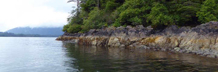
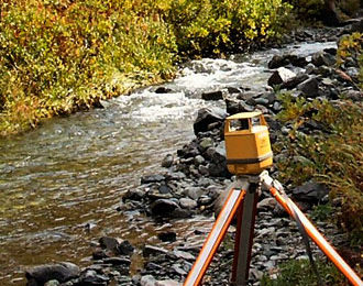
The Hydrologic Survey Unit collects, analyzes, interprets, and reports on Alaska's waters, including wetlands, glaciers, and coastal waters; provides scientific advice and hydrologic data on the quantity and quality of Alaska's surface and subsurface waters.
Dam Safety and Construction Unit
The Dam Safety and Construction Unit protects public safety and property by supervising the construction and operation of jurisdictional dams in Alaska; reviews periodic safety inspection reports; issues permits to construct, modify, repair, operate, remove or abandon dams; and participates in exercises of emergency action plans.
Alaska Water Facts
- Alaska has more than 40% of the entire nation's surface water resources
- About three-fourths of all fresh water in Alaska is stored as glacial ice that covers nearly 5% of the state
- Alaska has more than three million lakes, over 12,000 rivers, thousands of streams and creeks, and an estimated 100,000 glaciers
- Longest River: Yukon River, 1,280 miles in Alaska, draining 204,000 square miles
- Largest Lake: Iliamna Lake, 1,115 square miles
- Largest Glacier: Malaspina Glacier, 850 square miles
- Highest Average Annual Precipitation: 220 inches, Little Port Walter, S.E. Alaska
- Lowest Average Annual Precipitation: 4.8 inches, Barrow, Arctic Slope, Alaska
- Greatest 24-Hour Precipitation: 15.2 inches, Angoon, S.E. Alaska
- Highest Average Annual Snowfall: 540 inches, Thompson Pass
- Greatest 24-Hour Snowfall: 62 inches, Thompson Pass
- Statewide Average Annual Precipitation: 1,050,000 million gallons per day
- Statewide Average Consumptive Water Use: 27 million gallons per day
- Alaska Surface Water Inflow: 152,000 million gallons per day
- Alaska Surface Water Outflow: 989,000 million gallons per day
- Normal Reservoir Storage: 1.8 million acre-feet
- Total Estimated Water Use: 406 million gallons per day, 82% surface water, 18% groundwater
- Greatest Daily Tidal Range: 38.9 feet, Upper Cook Inlet
- Alaska Total Land Area: 586,000 square miles