
Navigability Project
Governor's Unlocking Alaska Initiative
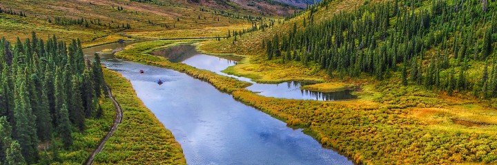
Governor Mike Dunleavy's "Unlocking Alaska" initiative is an important part of his effort to defend Alaskans' rights to access state resources, lands and waters. Specifically, it is an assertion of state management authority over submerged lands beneath navigable waters which the state has owned since statehood.
The Public Access Assertion and Defense unit has devoted two years and thousands of hours of dedicated staff time to compiling the information contained in the links below. They include a fact sheet on the initiative; a press release explaining the initiative; the U.S. Supreme Court's Sturgeon decisions affirming state management authority over navigable waters inside conservation system units created by the Alaska National Interest Lands Conservation Act of 1980 (ANILCA); maps showing how the initiative expands the extent of state-controlled waters inside these units; the methods and legal standards used in determining navigability; a list of pre-statehood withdrawals of land over which the state does not assert management; and a link to Alaska Mapper, a geographic information system (GIS) that lets users customize Alaska maps by adding layers depicting specific elements and features; and more.
Unlocking Alaska Initiative: Press Release (archived) U.S. Supreme Court's Sturgeon I decision PDF U.S. Supreme Court's Sturgeon II decision PDF Maps of navigable waters in ANILCA-created units before and after the initiative PDF Pre-statehood land withdrawals PDFMethods Document
Document describing the methods used to determine if waters would be considered navigable. (Pending)
Alaska Navigable Waters within Alaska National Park Service Units
Alaska Navigable Waters within the Tongass National Forest
Fishing and Fisheries Management
Navigability and access to waterways are distinct from fishing and fisheries management in Alaska. The ”Unlocking Alaska“ Initiative may not change federal fishery management authorities. Fishermen, whether for commercial, sport, subsistence, or personal fisheries, should always be aware of where they are fishing, should remember that state and federal agencies may have different fishing regulations, and should check current regulations before going fishing.
For state regulations, click here.
For federal subsistence fishing regulations, click here and here.