DMLW Environmental Assessment Map
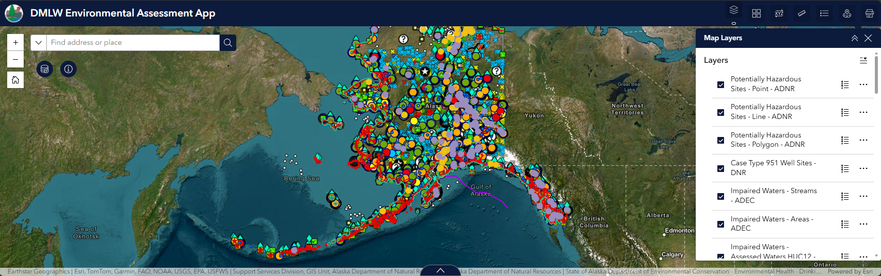
This interactive map provides a statewide view of potentially impaired lands and waters. It is designed to support awareness and bring multiple datasets into a single, user-friendly platform. The map integrates commonly used layers from Alaska Mapper, as well as data from Alaska Department of Environmental Conservation (ADEC) programs, the Formerly Used Defense Sites (FUDS) program, and the National Oceanic and Atmospheric Administration (NOAA). These layers help identify known or potential contamination sites, legacy hazards, and areas of environmental concern.
Users can explore site locations, review available attributes, and better understand how impaired lands intersect with state land.
View the Interactive Map GIS (April 2026)The information displayed on this map is provided for general reference and visual illustration purposes only. Source documents remain the official record. Consult the DNR Land Administration System (LAS) case file or the Recorders Office for additional information. Users are encouraged to verify information with the originating agency before relying on it for planning or decision-making purposes.