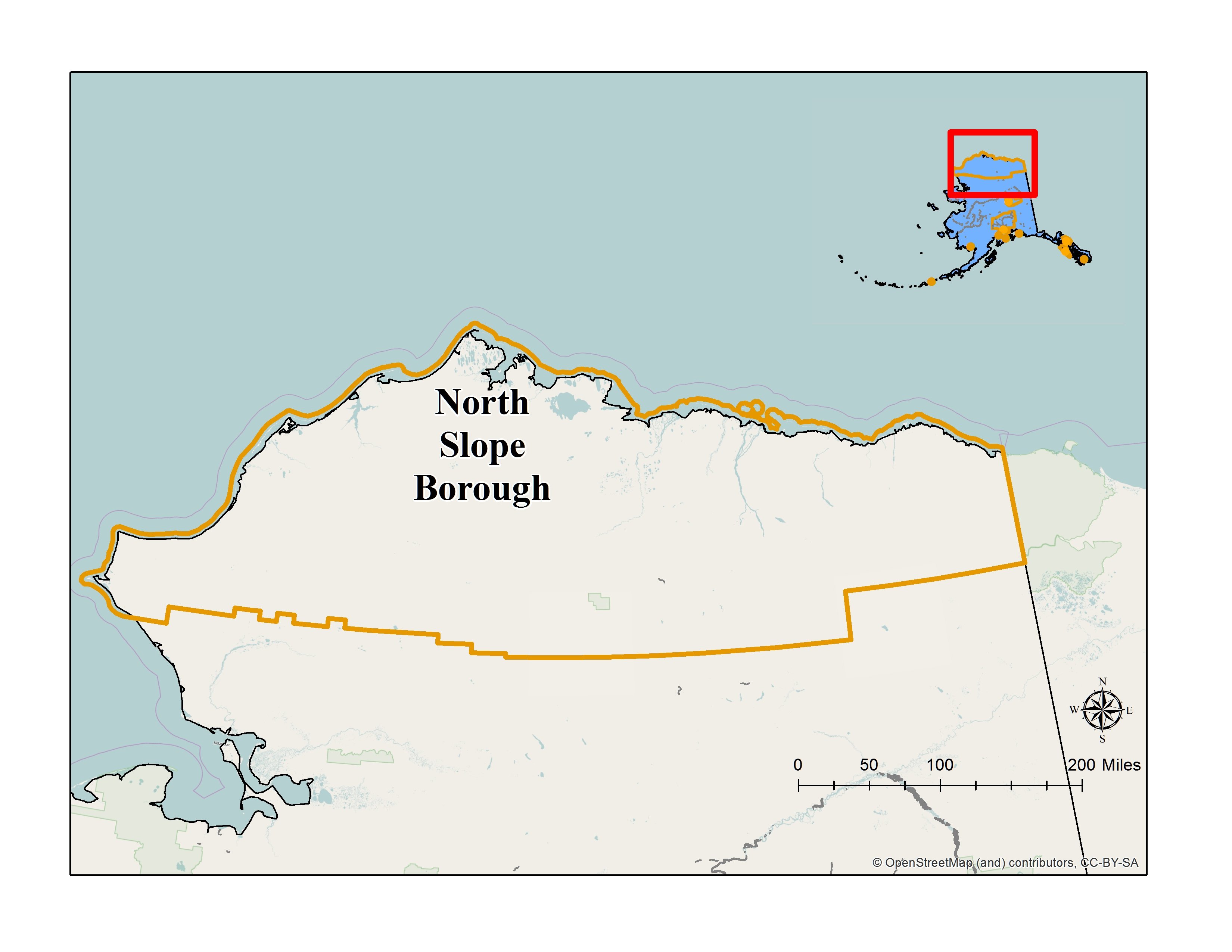
North Slope Borough
Non-Unified Home Rule Borough
2015 Population: 10,249
Size: 88,817.1 Square Miles
Commission on History, Language and Culture:
Date certified: April 20, 1987
 Commission Website
North Slope Borough's Municipal Code Section 2.16
Alaskan Community Profile

-
CLG Grants
Survey and Inventory Grants
Traditional Land Use Inventory Update. 2011.
Anaktuvuk Pass Traditional Land Use Inventory. 2001.Historic Preservation Education Grants
Protecting Cultural Resources Through Community Partnerships. Nuiqsut, Wainwright, Kaktovik, Pt. Hope, 2000; Atqasuk and Anaktuvuk Pass. 2001; Barrow and Point Lay, 2002.
Community Based Education to Strengthen Preservatin Elder and YouthCconferences. 1999.
Can the Past Be Saved? Symposium on the erosion of archaeological sites on the North Slope. 1991.
Learning from the Past: The Cultural Heritage of the North Slope. 1989.
Custodians of the Past II: The North Slope Borough Field School. 1987.Commission Training Grants
Local Historic Preservation Commission Training. 2009.
National Alliance of Preservation Commissions Forum. 2008, 2001.
CLG Workshop. 2001.
-
A Brief History
-
Some of the Inupiat people moved north of the Brooks Range and some moved east across the top of North America thousands of years ago. The abundant sea and land mammals and birds could sustain them, and the people adapted to the harsh Arctic climate and environment. Permafrost preserved a number of early Inupiat occupation sites, and archaeological investigations have been valuable to understand how people lived in the area over the years.
European explorers seeking to map the northwest corner of North America and looking for the fabled Northwest Passage reached the area at least by the 1770s and had contact with the Inupiat. Great Britain's Sir John Franklin is credited with discovering the Northwest Passage, though he died trying to navigate through it when his ships were caught in the ice in 1847.
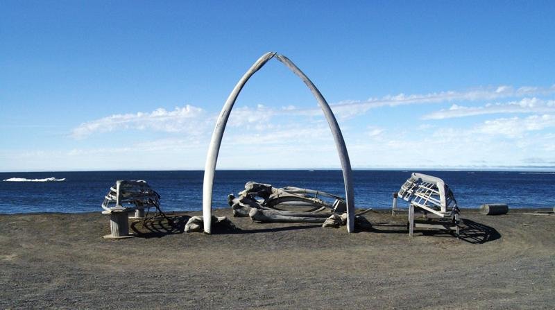
Major changes to the lifestyle of the Alaska Inupiat started the same year as Franklin's accomplishment. British and American whalers started to hunt bowhead whales near Alaska's northwest coast in 1845. In a few years, more than 200 whaling ships were hunting north of the Bering Strait. Most years at least one ship was caught in the sea ice, and many years crews that survived wintered in one of the Native villages. In 1871 the sea ice trapped a number of ships and 1,200 whalers spent the winter in the Arctic. When steam whaling started in the 1880s, ships arrived earlier, ventured further east to the Mackenzie River delta, and stayed longer—some overwintering. That same decade shore-based whaling stations opened. The station agent hired Native crews to hunt whales and paid them with European trade goods and foods.
The U.S. Government started the annual Revenue Marine Service patrol of Arctic waters in 1881. The cutters helped many whaling ships, maintained order, and introduced American laws and government to the Inupiat. The cutters brought materials and personnel for schools, a hospital, and mission stations. Air travel to and around the area started in the late 1920s making the area less isolated. In 1935, aviation pioneer Wiley Post and humorist Will Rogers were killed when their airplane crashed near Barrow. The site is a recognized historic place.
Shortly after Alaska became a state in 1959, Barrow residents challenged the state's game management laws when a number of men showed up at the local magistrate's house holding waterfowl they hunted out of season. Known as the Barrow Duck-in, it is one of a number of encounters by the long-time residents to fight to retain their traditional lifestyle for those who wished to practice it. Earlier in the century, Inupiat from several villages had left their home sites--among them Anaktuvuk Pass, Kaktovik and Nuiqsuit, and in the 1960s and 1970s the families reestablished the villages. The people created the North Slope Borough in 1966, encompassing over 88,000 square miles of land. .
Early explorers, scientists, and mappers of the North Slope reported large oil seeps on the coastal plain. In 1920 the U.S. Government established the Naval Petroleum Reserve, encompassing the western half of the North Slope. Some exploration for oil in the reserve was done, mostly in the 1940s, but no large scale development of an oil field happened. Under the Statehood Act, Alaska was awarded land and among its first selections were tracts of land available just east of the reserve. The state opened some of the tracts for oil leasing and in 1968 the discovery of the huge Prudhoe Bay oil field was announced. The Trans-Alaska Pipeline to transport the oil to market was completed in 1978 and the huge construction project included building the Dalton Highway through the Brooks Range connecting Prudhoe Bay to the Alaska road system.
The U.S. military established Distant Early Warning or DEW-Line stations for communication across the North Slope during the Cold War. They also established the Naval Arctic Research Laboratory at Barrow. One proposed government project, known as Project Chariot, planned to use nuclear power to blast a deep water harbor near Point Hope. Residents and national environmental groups questioned the project and it was shelved. Others recognized the significance and fragility of the Arctic coastal plain, and starting in the 1950s advocated for designating the eastern half of it a wildlife reserve. The year after Alaska became a state, President Eisenhower signed legislation creating the Arctic Wildlife Range, and in 1980 it was enlarged and named the Arctic National Wildlife Refuge (ANWR).
-
-
National Register of Historic Places Listings

Birnirk Site Address restricted Point Barrow Refuge Station Browersville Rogers-Post Site 13 miles SW of Barrow Utkeagvik Church Manse Momegan St. Leffingwell Camp Site West of Barter Island Ipiutak Archeological District Address restricted Ipiutak Site Address restricted Prudhoe Bay Oil Field Discovery Well Site 200 miles southeast of Barrow Gallagher Flint Station Archeological Site Address restricted Aluakpak Address restricted Anaktuuk Address restricted Atanik Address restricted Avalitkuk Address restricted Ivishaat Address restricted Kanitch Address restricted Napanik Address restricted Negilik Site Address restricted Uyagaagruk Address restricted
