Rex Trail: Small Vehicle Lake Reroute
Small Vehicle Reroute Pilot Project Study
The Division of Mining, Land & Water (DMLW) received a grant in 2011 through the "Recreational Trails Program" in the amount of $100,000. DMLW contracted with Interior Trails on June 12, 2013 to provide a prescription report for four sites within the first nine miles of the Rex Trail. Interior Trails provided a prescription report for the four sites, including "Site 4," located approximately 8.5 miles east of the Parks Highway on the Rex Trail near Anderson (see map).
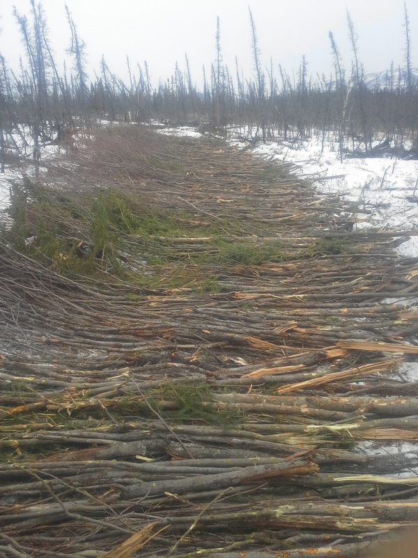
The prescription report provided options for two different Rex Trail use patterns. The first use pattern contemplated the existing restricted usage, consisting of ATV's under 1,500 pounds and (via permit) rubber-tracked vehicles under 25,000 pounds. The second use pattern contemplated usage by all of the above as well as wheeled vehicles up to 15,000 pounds. On Site 4, the options for the restricted usage pattern were to 1) provide a realignment for ATV traffic to the south of the existing trail, built to a 6' wide traveling surface and constructed using a ditch and elevate technique placed atop locally harvested corduroy upon undisturbed vegetation, then capping with 2" of on-site gravel, or 2) construct in the same fashion but without a gravel cap. For the expanded use pattern, the options were 1) the same small vehicle reroute options or 2) build a highway-style gravel causeway. DMLW chose to implement the first option (gravel-capped corduroy ditch-and-elevate small vehicle reroute) as a pilot project. The initially estimated cost for the option was $42,161.
On July 30, 2013, DMLW employees conducted a wetland delineation for the Site 4 reroute area in order to apply for a "Nationwide" Corps of Engineers (COE) permit. Interior Trails' contract was amended to flag the specific on-the-ground small vehicle realignment route. A COE permit was acquired on April 14, 2014. An invitation for quote was issued on May 30, 2014 for construction of the Site 4 small vehicle reroute but no bids were received. The invitation for quote was reissued with minor modifications on June 20, 2014. Three bids were received, and a Notice of Award in the amount of $93,780 was issued on July 11, 2014 to the low offeror, Gillmore Construction.
Construction was originally planned for summer. However, DMLW employees visited Site 4 on July 17, 2014 and discovered that the trail was predominantly submerged, in many places to depths greater than 3 feet, and barely passable, even via six-wheeled Argos. See: https://www.newsminer.com/news/local_news/it-s-official-wettest-summer-in-a-nearly-a-century/article_7e15ada0-2fcc-11e4-a250-0017a43b2370.html
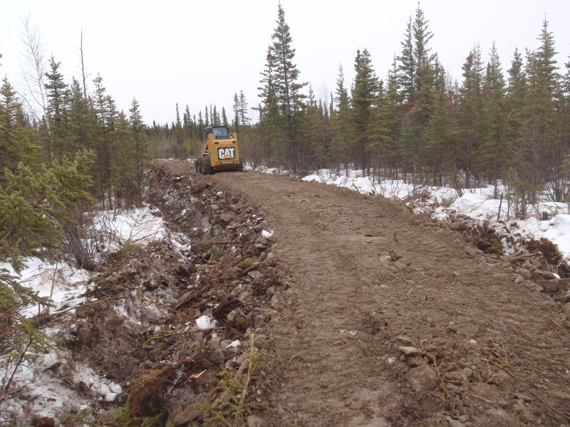
As the trail was impassable to the necessary construction equipment, DMLW extended the contract through June 30, 2015 to allow for winter construction.
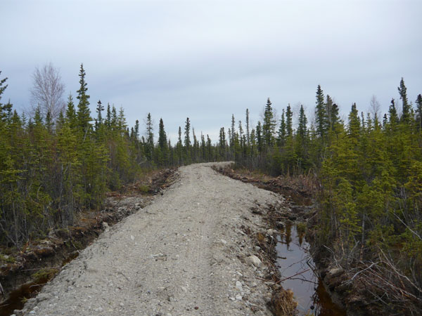
Construction of the reroute occurred the following spring, between February 20 and March 10, 2015. The reroute was constructed according to instructions, but some issues unavoidably arose from the particular environment and winter construction. First, there was insufficient appropriately sized corduroy from the area cleared for the trail; DMLW had to authorize additional clearing to obtain the necessary corduroy. Second, material obtained from the ditches and used atop the corduroy had a high woody or vegetative component, and, beneath that, the remainder of the material was largely ice. The ditched material thus could not be effectively compacted to specification, and, in any event, contained insufficient particulate soil to effectively cover the underlying corduroy. The contractor recommended and applied additional gravel (6 inches rather than 2), which likely improved the final condition of the trail. While long term durability cannot yet be evaluated, inspections on May 8, 2015 and August 20, 2015 revealed that the trail surface, while drivable, is relatively rough and uneven, likely as a result of melting of the ice-rich material. Existing braids off the main trail did not appear to be recently used, and no new braids were noted. Continued monitoring will be conducted to evaluate effectiveness of traffic separation, durability and longevity of reroute, and rehabilitation of previously braided areas.